Nasjonal turistveg Andøya

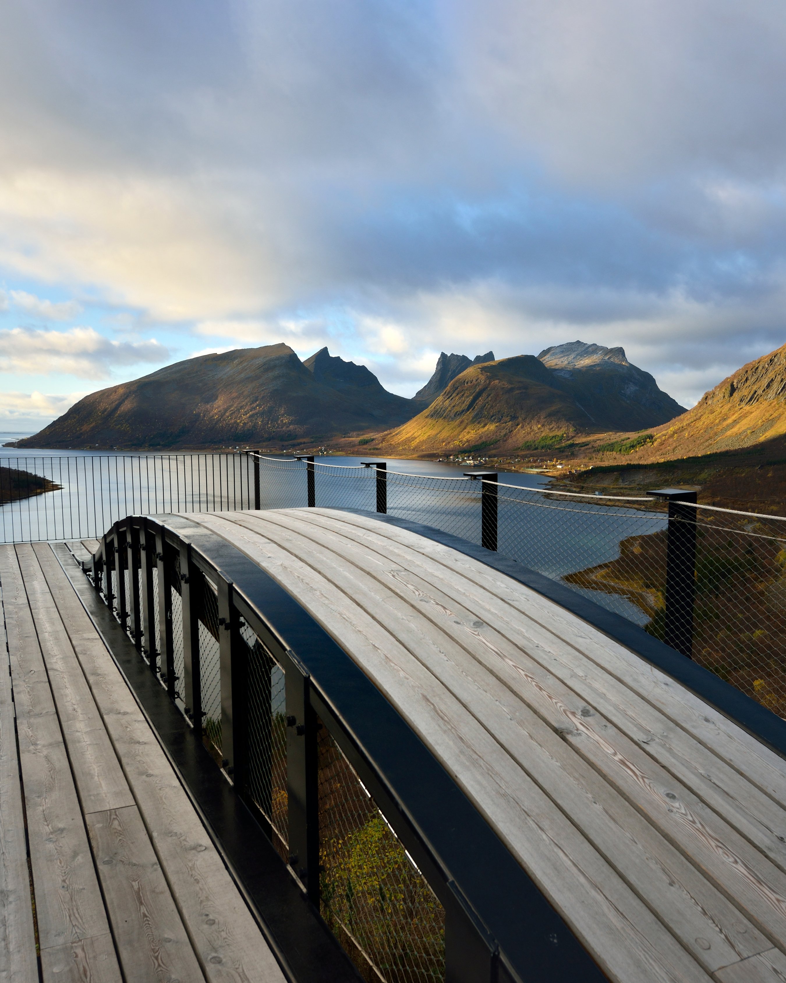
Where the ocean comes ashore
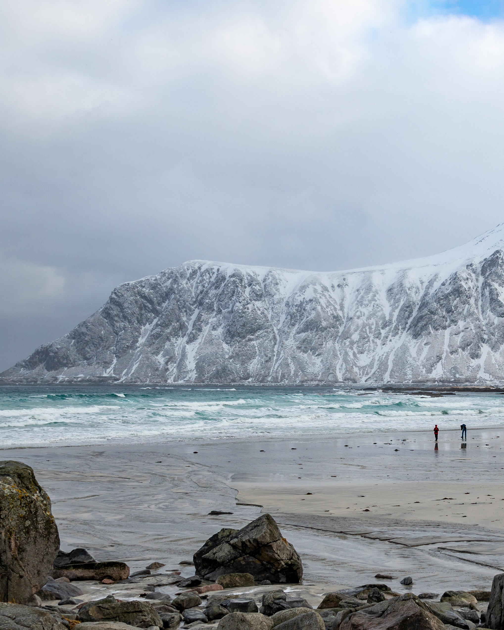
On the drive through landscape unprotected from the Norwegian Sea, the fishing village of Bleik depicts the encounter between man and nature.
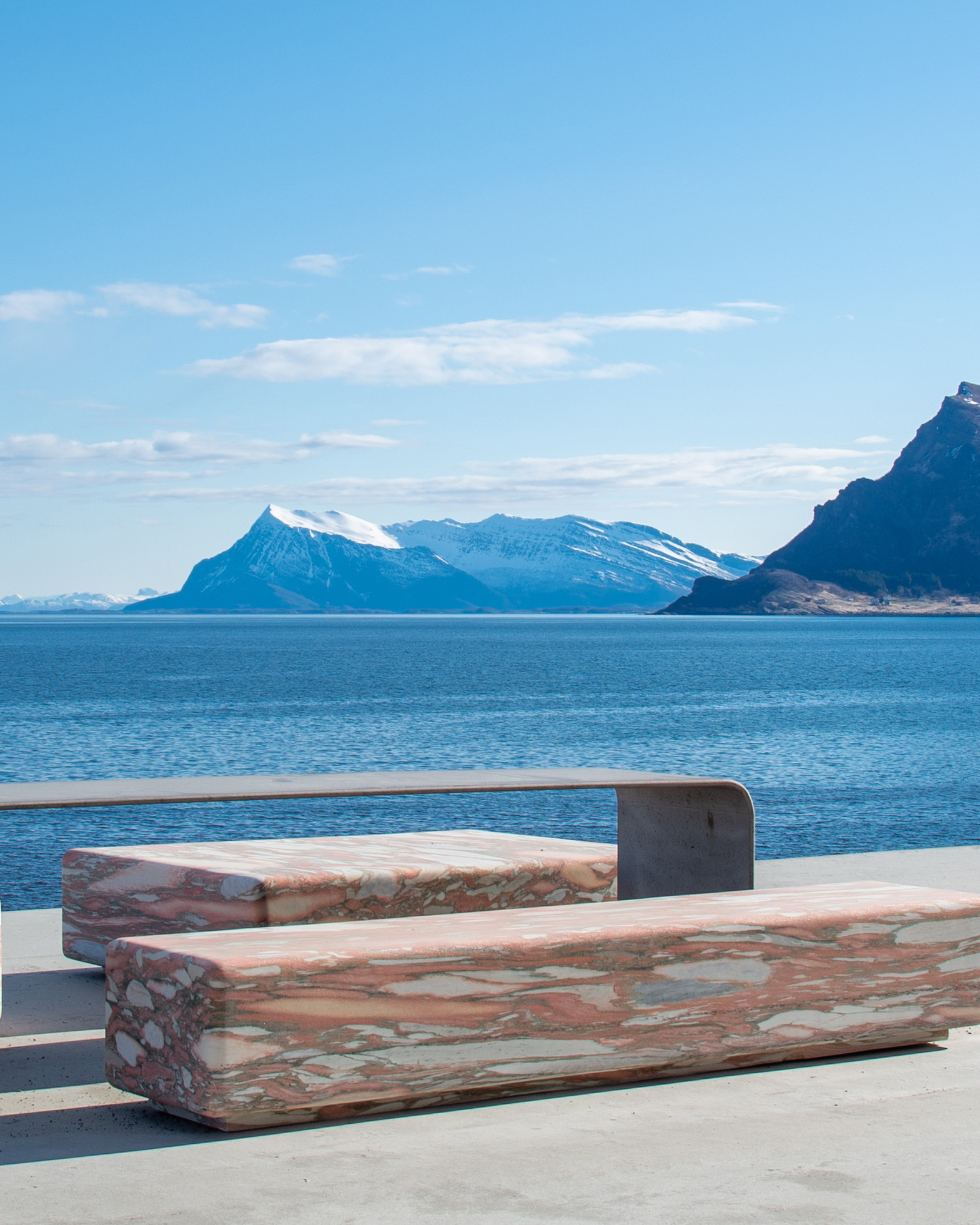
On the island of Andøya you can wander along some of Norway’s most beautiful beaches and look out over the still waters of the ocean with the midnight sun as your sole companion. The road itself follows a broad shelf of cultivated land where people live between the wide ocean and the jagged peaks.
If you’re lucky you might see seals, whales and eagles from your car window. The Gulf Stream makes for a hospitable climate and turns the ocean into an abundant source of food for a rich variety of bird and animal life.
Andøya also provides a fine stretch of road for cyclists and if you want to view the island from the sea, there are lots of opportunities for kayaking.
Map of the route
Closed for the winter
- Closed:
- Estimated open:


Travel information
- Length
- 58 km
- MASL
- 0 – 65
Norwegian Scenic Route Andøya runs along the outer edge of Andøya between Andenes and Bjørnskinn [82] [7702] [7698]. In the summer season there is a ferry between Andenes and Gryllefjord linking the Andøya and Senja scenic routes. The link leads to maps of ferry routes, click on the ferry icon in the map for timetables.
Together with Senja, Andøya is an outer alternative to [E6] and the Hurtigruten coastal express.
For cyclist: The route is relatively easy to cycle, but you should check the weather forecast, not to mention the wind speed and direction, before you decide where to start. Norwegian Scenic Route Andøya is part of National Cycle Route 1, which runs along the entire coast of Norway. From Bergen to Nordkapp the route also coincides with EuroVelo 1 «Atlantic Coast Route». The route is signposted.
Veg og trafikkinformasjon
Map information
- GPS, Andenes:
- 69.324167, 16.1325
- GPS, Bjørnskinn:
- 68.989779, 15.646872
Gpx file download for gps and navigation app.
In this file, the direction of travel is from Bjørnskinn to Andenes. Gpx files for all Scenic Routes. Any alternative driving patterns, must be adapted by the users themselves.
Information
Emptying toilets from motorhomes and caravans is not permitted in our toilets. The facility is not designed for such use. The nearest dump station is at Andenes.
-

Photo 1 of 12: Bukkekjerka. Photo: Espen Bergersen -

Photo 2 of 12: Nøss. Norwegian Scenic Route Andøya. Photo: Jarle Wæhler, Statens vegvesen -

Photo 3 of 12: Stave. Norwegian Scenic Route Andøya. Photo: Trine Kanter Zerwehk -

Photo 4 of 12: Norwegian Scenic Route Andøya. Photo: Frid-Jorunn Stabell, Statens vegvesen -

Photo 5 of 12: Børvågen. Norwegian Scenic Route Andøya. Photo: Steinar Skaar, Statens vegvesen -

Photo 6 of 12: Leirviktjønna, Nordmela. Norwegian Scenic Route Andøya. Photo: Steinar Skaar, Statens vegvesen -

Photo 7 of 12: Måtinden. Norwegian Scenic Route Andøya. Photo: Espen Bergersen, Naturgalleriet.no -

Photo 8 of 12: Nordmela. Norwegian Scenic Route Andøya. Photo: Roger Ellingsen, Statens vegvesen -

Photo 9 of 12: Norwegian Scenic Route Andøya. Photo: Espen Bergersen, Naturgalleriet.no -

Photo 10 of 12: Bøveien. Norwegian Scenic Route Andøya. Photo: Roger Ellingsen, Statens vegvesen -

Photo 11 of 12: Bleik. Norwegian Scenic Route Andøya. Photo: Roger Ellingsen, Statens vegvesen -

Photo 12 of 12: Andenes. Norwegian Scenic Route Andøya. Photo: Steinar Skaar, Statens vegvesen
Experiences
The best way to experience the contrasting landscape of Andøya is to take a hike along the exposed shoreline. On foot you have plenty of options to explore Andøya on your own and create your own unique experiences.
Enjoy the midnight sun from the island’s most popular peak, Måtinden; feel the sand between your toes on the Bleikstrand beach; or walk among the ancient moraines in Bleikmorenen Nature Reserve. If you wish to get out on the sea, we recommend deep-sea fishing or a whale safari – both great alternatives. The bird rock on the island of Bleiksøya is a great experience.
Since the launching of its first research rocket in 1962, Andøya has been at the centre of an exciting part of Norway’s space travel history. Andøya Spaceport is the Norwegian spaceport, providing launch services for small satellites to polar and sun-synchronous orbits. The satellites that are launched are used for communication, earth observation, navigation etc. In connection with launches, the road will be closed at times.
Useful links
-
The official travel guide to Norway
-
Ferry routes and timetables (Norwegian)
-
Travel by bus, train, ferry, metro and plane
-
Good advice for campers
-
Plan your trip and familiarize yourself with the traffic rules in Norway
De 18 nasjonale turistvegene
Nasjonale turistveger er kjøreturer gjennom vakker norsk natur. Opplevelsen forsterkes med nyskapende arkitektur og tankevekkende kunst på tilrettelagte utsiktspunkter og rasteplasser.
![]()