Scenic route Gaularfjellet
From Sognefjorden to Fosseheimen, the realm of falling waters
A peaceful alternative to the main roads from Sunnfjord to Sogn. Along protected waterways and a quiet fiord towards the tourist destination of Balestrand
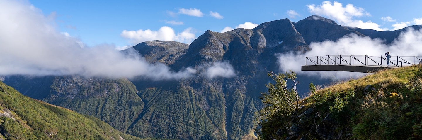
Gaularfjellet is a well-preserved secret for most people. The drive runs along the fiord before the road begins its sharply meandering climb up towards the top of the mountain. From the rest area of Utsikten you can admire the view of a lush and beautiful landscape and the road winding its way up the hill.
The road follows Gaularvassdraget, a protected watercourse offering everything from wild rapids and waterfalls to calm stretches where the water glides quietly along. A walk over the exciting bridge at Likholefossen waterfall gives you a sense of being in the midst of the swirling cascades. The Scenic Route can be included in a number of circular trips.
Map of the route
Closed for the winter
- Closed:
- Estimated open:


Travel information
- Length
- 114 km
- MASL
- 0 – 784
Norwegian Scenic Route Gaularfjellet runs between Moskog and Balestrand [55][613] and between Sande and Eldalsosen [610]. From Balestrand you can make beautiful detours. A boat trip that ends almost at the Jostadalsbreen glacier is a wonderful way to experience the natural surroundings.
For cyclists: Start your bike ride at Moskog, so that the climbs up towards Rørvikfjellet and towards the top of Gaularfjellet will not be too strenuous. An alternative is to start at Sande. From the Utsikten viewpoint and down to the fiord, the road is a steep downhill ride.
Traffic and road information
Telephone +47 815 48 991
Traffic alerts in map (Norwegian only)
Traffic alerts in telephone app (Norwegian only)
Map information
- GPS, Moskog:
- 61.442148, 6.009575
- GPS, Balestrand:
- 61.210477, 6.528711
- GPS, Sande:
- 61.326786, 5.797906
Gpx file download for gps and navigation app.
In these files, the direction of travel is from Sande to Balestrand and from Moskog to Balestrand. Gpx files for all Scenic Routes. Any alternative driving pattern must be adapted by the users themselves.
Information
Emptying toilets from motorhomes and caravans is not permitted in our toilets. The facility is not designed for such use. The nearest dump stations are at Balestrand and Førde.
Vinterinformasjon
The road over Gaularfjellet between Mel and Mjell is closed in winter. Previous closures are 20 November and 3 January. Previous openings are 11 April and 2 May. NOTE! After opening, the road may be closed for a period at night and in bad weather. Click on the snow icon in the map for information about closures.
-

Photo 1 of 14: Sværefjorden. Photo: Roger Ellingsen, Statens vegvesen -

Photo 2 of 14: Balestrand. Photo: Jarle Wæhler, Statens vegvesen -

Photo 3 of 14: Bårddalen. Photo: Trine Kanter Zerwekh, Statens vegvesen -

Photo 4 of 14: Utsikten. Photo: Hilde M Strangstadstuen, Statens vegvesen -

Photo 5 of 14: Utsikten. Photo: Frid-Jorunn Stabell, Statens vegvesen -

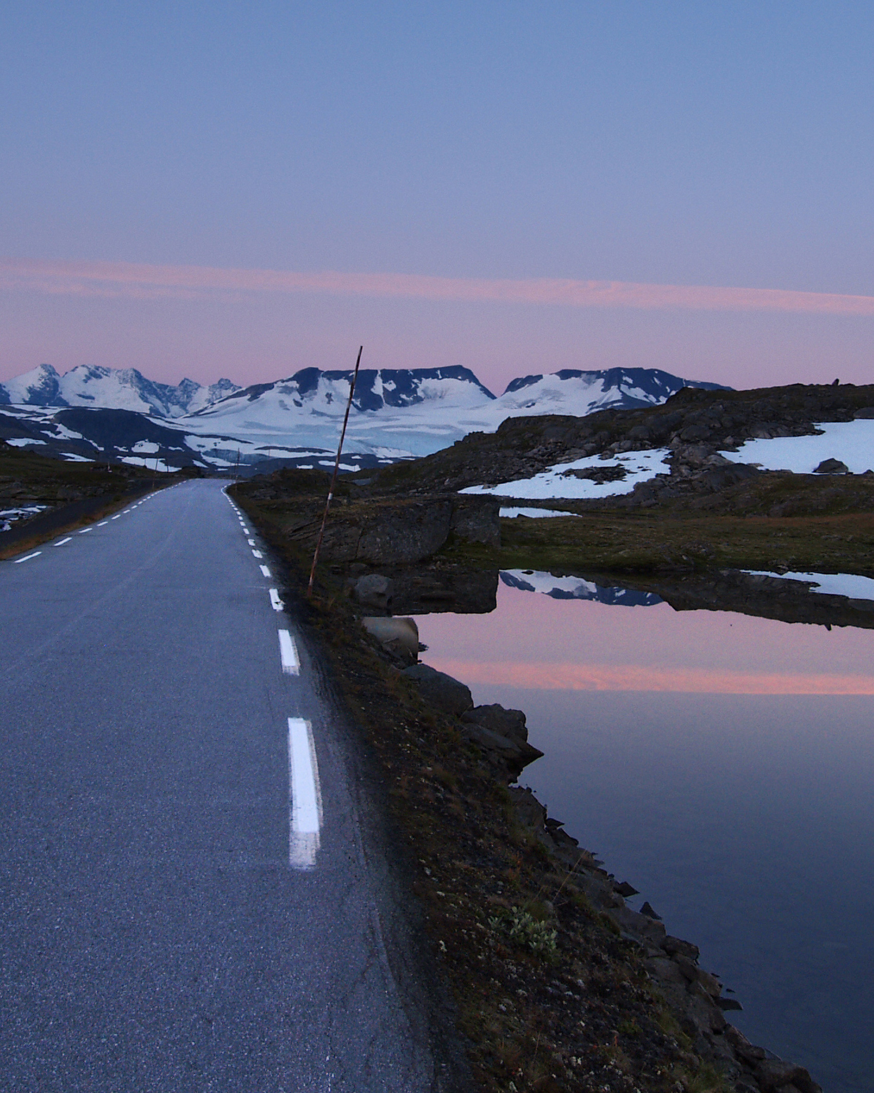
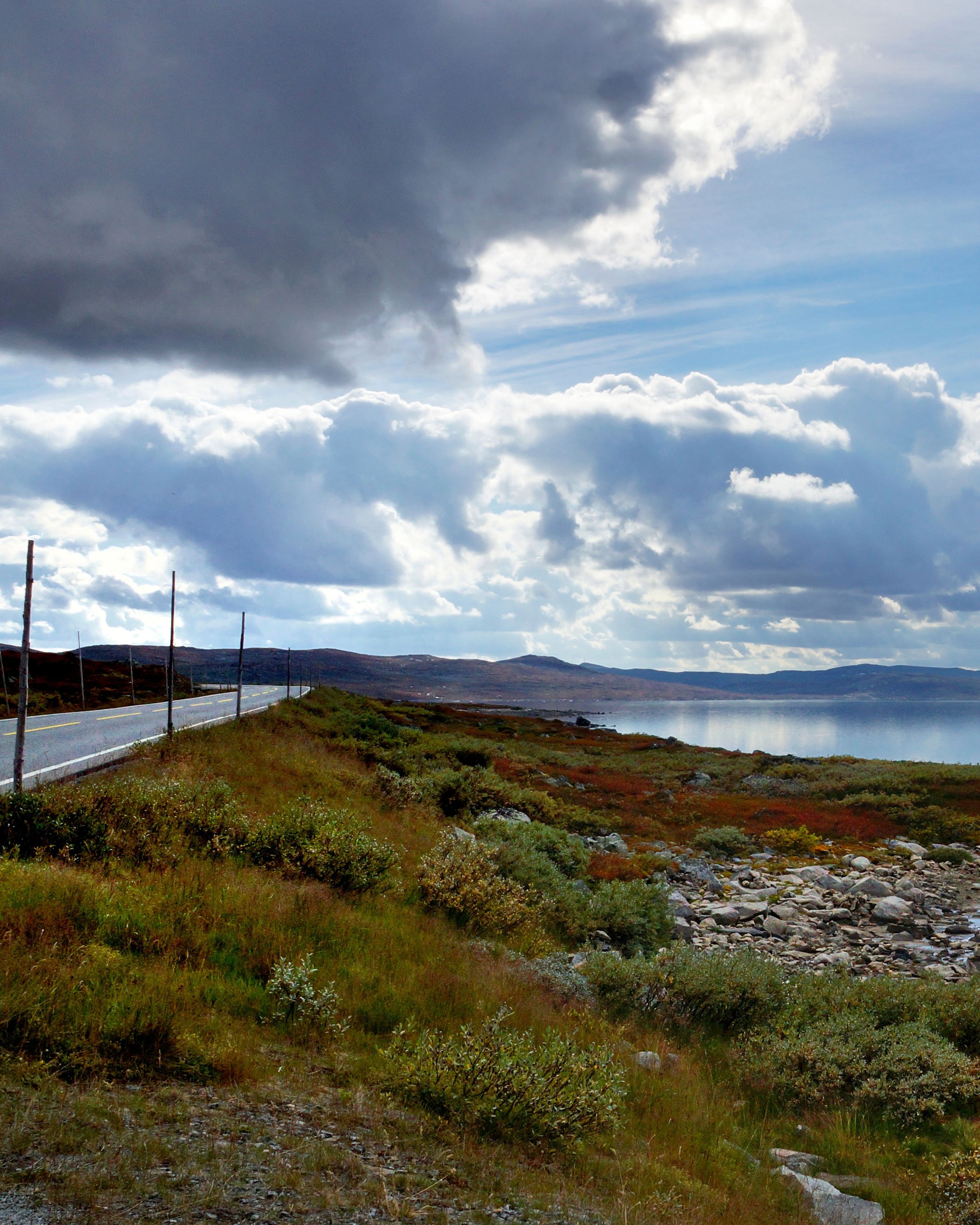
Photo 6 of 14: Nystølsvatnet. Photo: Bjørn Andresen, Statens vegvesen -

Photo 7 of 14: Nystølsvatnet. Photo: Jarle Wæhler, Statens vegvesen -

Photo 8 of 14: Eikelandsfossen. Photo: Trine Kanter Zerwekh, Statens vegvesen -

Photo 9 of 14: Likholefossen. Photo: Jarle Wæhler, Statens vegvesen -

Photo 10 of 14: Holmevatnet. Photo: Frid-Jorunn Stabell, Statens vegvesen -

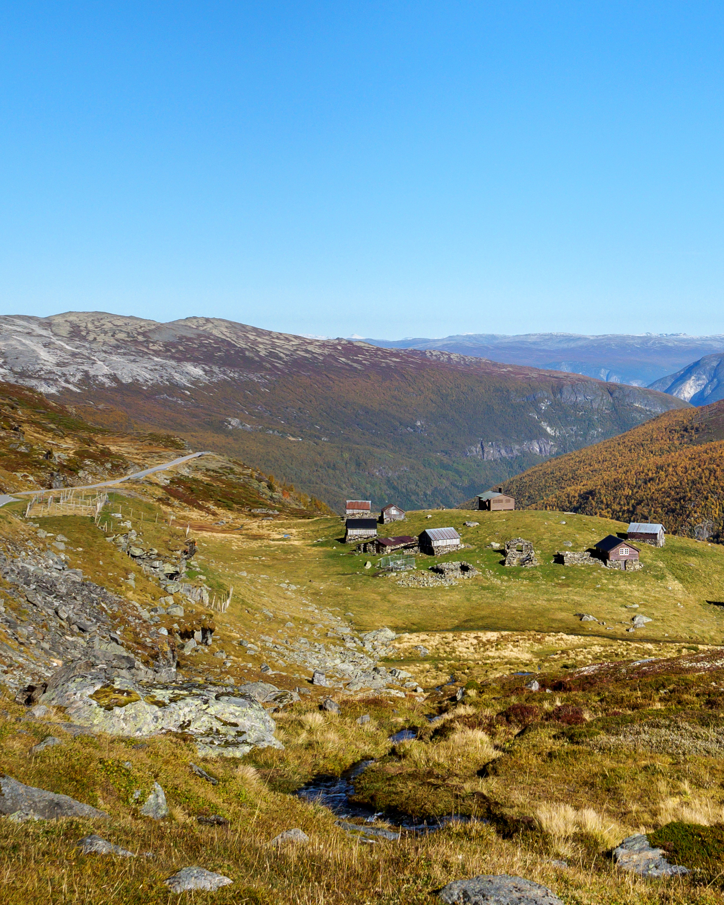
Photo 11 of 14: Hestad. Photo: Bjørn Andresen, Statens vegvesen -

Photo 12 of 14: Hestad. Photo: Frid-Jorunn Stabell, Statens vegvesen -

Photo 13 of 14: Råheimselva, Viksdalen. Photo: Frid-Jorunn Stabell, Statens vegvesen -

Photo 14 of 14: Balestrand. Photo: Trine Kanter Zerwekh, Statens vegvesen
Experiences
This road soon became an important travel route when it was opened in 1938. Today, the road is a peaceful alternative to the main roads that absorb most of the traffic.
Balestrand is a great place to start the trip, from where you are also advised to take a boat to Fjærland and visit the glacier museum. There are simple and functional points along the entire route where it is easy to stop and stretch your legs or just enjoy the view. The Gaula river has 29 large waterfalls, with Likholefossen and the bridge across it as one of the highlights.
The 21-km-long Fossestien Waterfall Trail runs along the Gaula river, parallel to the Scenic Route. You can walk the trail in its entirety, or choose a shorter section. The trail runs past a number of waterfalls and through a lush cultural landscape with active farms. Along the route you will also find mountain hikes to spectacular viewpoints and quiet mountain lakes where fishing is possible.
Useful links
-
The official travel guide to Norway
-
Travel by bus, train, ferry, metro and plane
-
Good advice for campers
The 18 Norwegian Scenic Routes
Norwegian Scenic Routes are roads that run through unique Norwegian nature. Along the roads you will find artworks, viewpoints and rest areas with innovative architecture in beautiful landscapes.
![]()