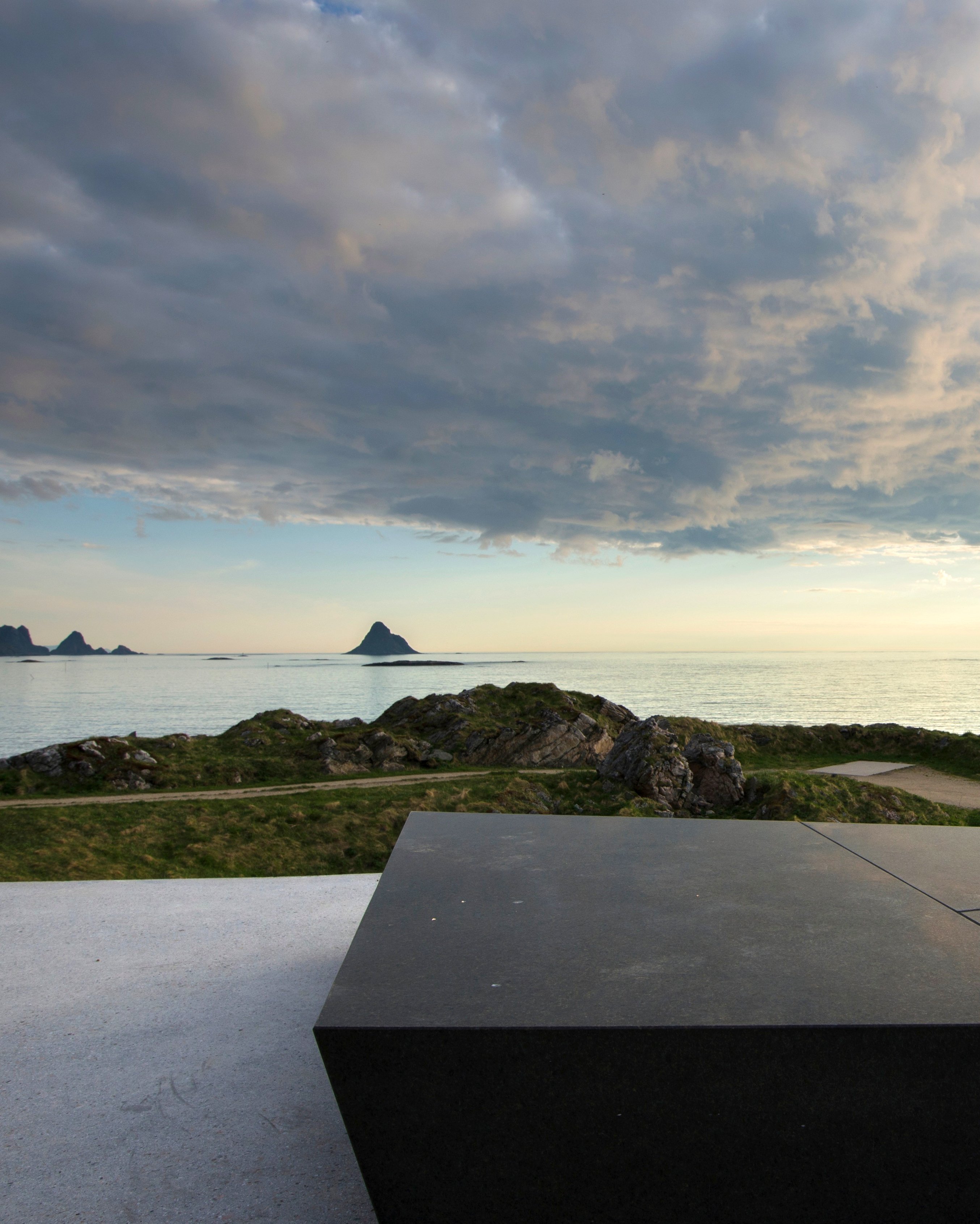
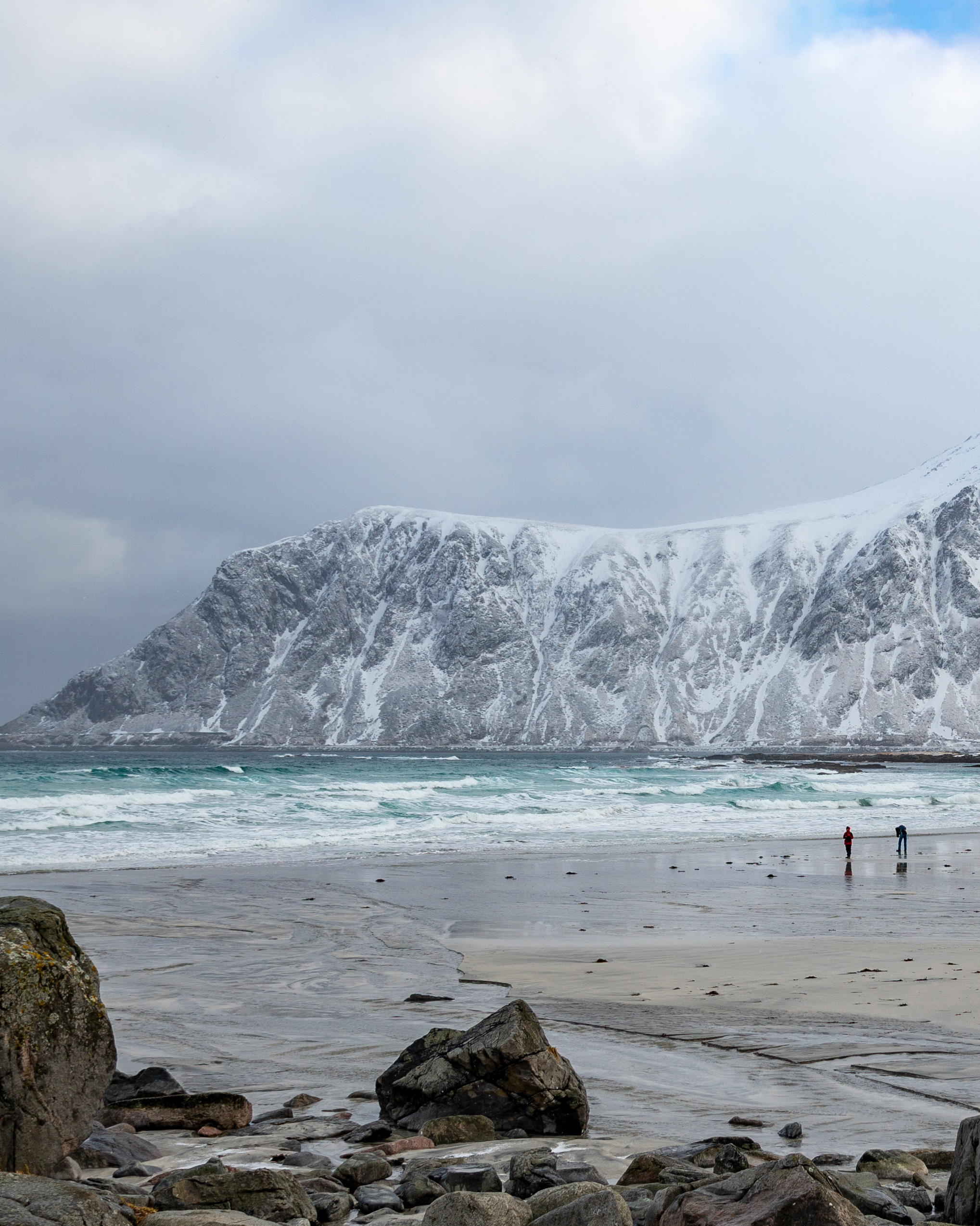
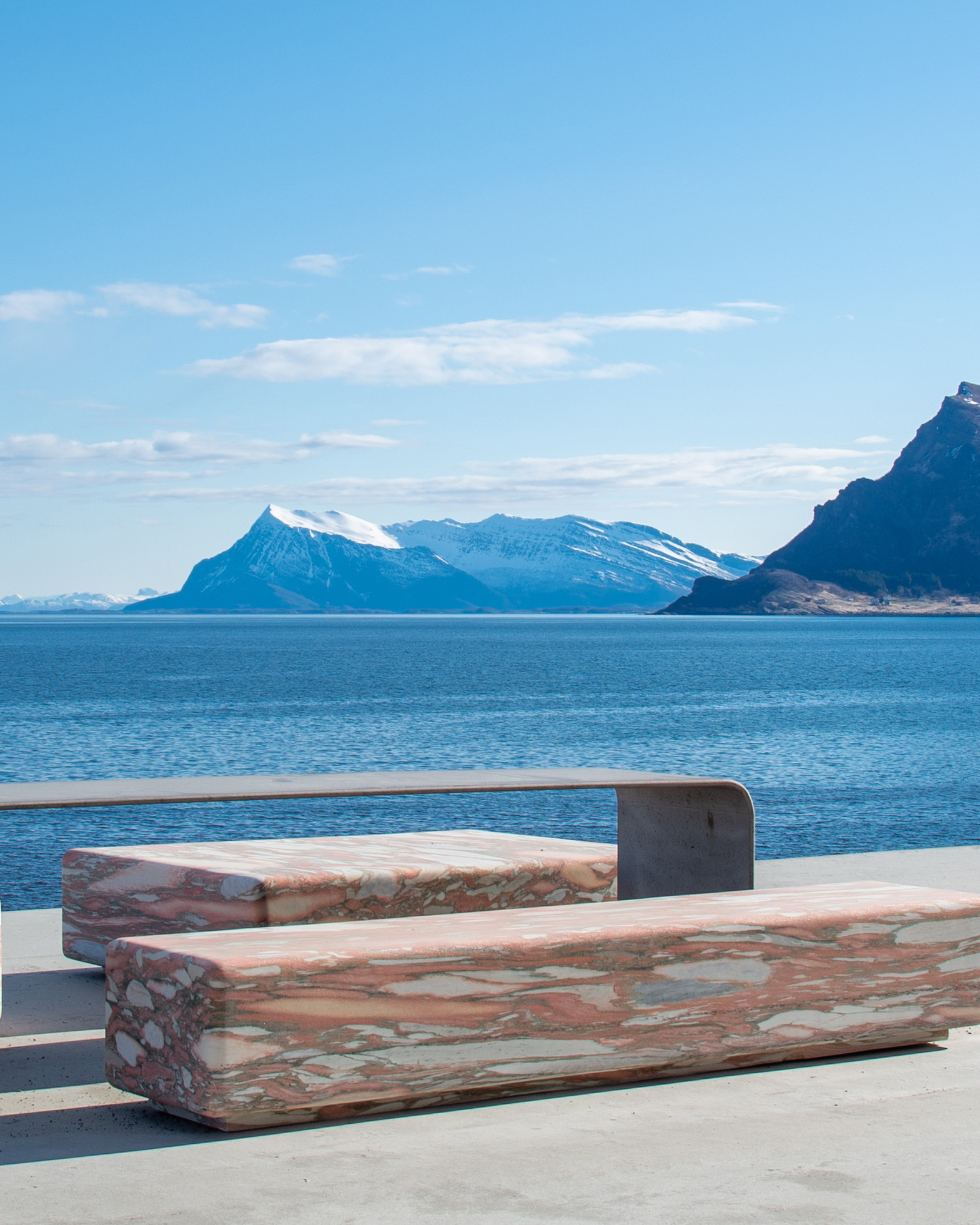
Scenic route Senja
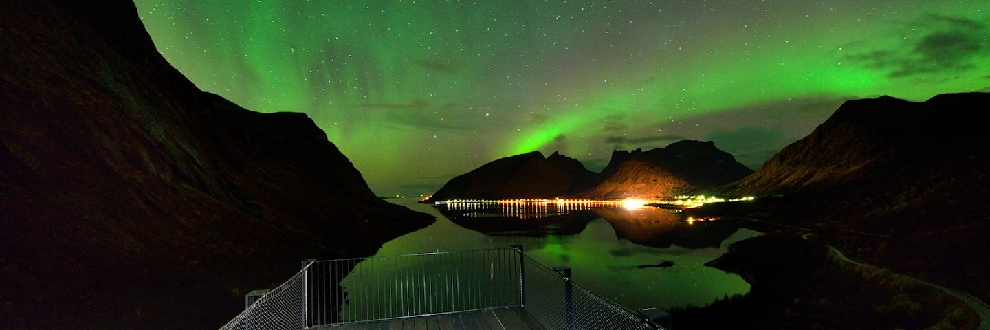
Ocean, fjords and mountains
The drive along the west coast of Senja offers a journey through changing landscapes.
The steep mountains plunging straight into the ocean are a breathtaking sight, and the most prominent feature on this route.
The road twists and turns along deep fiords and through villages that cling to the narrow stripe between mountains and sea.
Just as dramatic as the mountain peaks of Okshornan rising up from the sea, just as serene is Senja with its idyllic islets and skerries in Bergsfjord. Detours from the road to the fishing villages of Husøy, Bøvær and Mefjordvær are great experiences.
Map of the route
Closed for the winter
- Closed:
- Estimated open:


Travel information
- Length
- 102 km
- MASL
- 0 – 287
Norwegian Scenic Route Senja runs between Botnhamn and Gryllefjord [862] [86], with short detours to Husøy [7886] and Mefjordvær [7868]. Together with Norwegian Scenic Route Andøya it provides an outer alternative to ([E6] and the Hurtigruten coastal express). Since Senja is an island you must cross the bridge from the mainland ([E6] via Finnsnes) or take the ferry between Botnhamn-Brensholmen or Gryllefjord-Andenes. The links lead to maps of ferry routes, click on the ferry icon in the map for timetables.
The ferry from Gryllefjord - Andenes links the Scenic routes Senja and Andøya. The ferry from Botnhamn - Brensholmen can be your route from Senja to Tromsø.
For cyclists: The route may be experienced as relatively hilly, but is absolutely manageable. Norwegian Scenic Route Senja is part of National Cycle Route 1, which runs along the entire coast of Norway. From Bergen to Nordkapp the route also coincides with EuroVelo 1 «Atlantic Coast Route». The route is signposted.
Traffic and road information
Telephone +47 815 48 991
Traffic alerts in map (Norwegian only)
Traffic alerts in telephone app (Norwegian only)
Map information
- GPS, Botnhamn:
- 69.505833, 17.902222
- GPS, Gryllefjord:
- 69.362778, 17.053889
Gpx file download for gps and navigation app.
In this file, the direction of travel is from Gryllefjord to Botnhamn. Gpx files for all Scenic Routes. Any alternative driving pattern must be adapted by the users themselves.
Information
Emptying toilets from motorhomes and caravans is not permitted in our toilets. The facility is not designed for such use. The nearest dump stations are at Skaland, Senjahopen and Mefjordvær.
-

Photo 1 of 11: Bergsbotn. Norwegian Scenic Route Senja. Photo: Jarle Wæhler, Statens vegvesen -

Photo 2 of 11: Bergsbotn. Norwegian Scenic Route Senja. Photo: Hugo Fagermo, Statens vegvesen -

Photo 3 of 11: Tungeneset. Photo: Trine Kanter Zerwekh, Statens vegvesen -

Photo 4 of 11: Husøy. Norwegian Scenic Route Senja. Photo: Jarle Wæhler, Statens vegvesen -

Photo 5 of 11: Husøya. Norwegian Scenic Route Senja. Photo: Jiri Havran -

Photo 6 of 11: Hamn. Norwegian Scenic Route Senja. Photo: Trine Kanter Zerwekh, Statens vegvesen -

Photo 7 of 11: Finnsæter. Norwegian Scenic Route Senja. Photo: Roger Ellingsen, Statens vegvesen -

Photo 8 of 11: Mefjordvær. Norwegian Scenic Route Senja. Photo: Werner Harstad, Statens vegvesen -

Photo 9 of 11: Bergsfjorden. Photo: Trine Kanter Zerwekh, Statens vegvesen -

Photo 10 of 11: Bøvær. Photo: Jarle Wæhler, Statens vegvesen -

Photo 11 of 11: Bøvær. Photo: Trine Kanter Zerwekh, Statens vegvesen
Experiences
Senja offers great nature experiences and is like a big adventure park for those who enjoy a challenge. The options are many, and for anyone who enjoys fishing, hiking, climbing, kayaking, scuba diving or free-ride skiing down steep mountainsides, Senja is perfect. In addition there are many lovely beaches you can visit.
High mountains and coastal landscapes provide an abundance of hiking options on Senja, and even the easiest walks offer great experiences. Not far from Hamn you will find Sukkertoppen, a challenging mountain hike with stunning views both along the way and from the top. Husfjellet is a far gentler hike that offers great photo opportunities of Mount Oksen with its sharp peaks. The walk to the Russehula cave near Mefjordvær lets you experience closeness to both mountains and sea.
Useful links
-
The official travel guide to Norway
-
Ferry routes and timetables (Norwegian)
-
Travel by bus, train, ferry, metro and plane
-
Good advice for campers
-
Plan your trip and familiarize yourself with the traffic rules in Norway
The 18 Norwegian Scenic Routes
Norwegian Scenic Routes are roads that run through unique Norwegian nature. Along the roads you will find artworks, viewpoints and rest areas with innovative architecture in beautiful landscapes.
![]()