Nasjonal turistveg Geiranger – Trollstigen
Bendy roads along precipitous mountains
A driving experience along a tourist route rich in tradition with the dramatic scenery that is distinctive to Western Norway.
A driving experience along a long-established scenic route with the dramatic west coast scenery of mountains and fiords, attracting tourists travelling by road or by boat.
Geiranger-Trollstigen offers numerous highlights, and the eleven hairpin bends of Trollstigen as well as the view from Ørnesvingen down to the Geiranger fiord may set your pulse racing.
Lush valleys, sheltered strawberry farms, precipitous mountains and viewpoints guaranteed to make you dizzy offer some of Norway’s most scenic views. Allow yourself enough time for the trip; stops will be welcome, whether to embrace the challenge of a summit hike or just to enjoy the view.
Map of the route
Closed for the winter
- Closed:
- Estimated open:


Travel information
- Length
- 104 km
- MASL
- 0 – 1038
- Sea crossing
- 1 ferry
Norwegian Scenic Route Geiranger-Trollstigen runs from Sogge Bru in Romsdalen and Langvatnet to Strynefjellet [63]. On part of this stretch you must take a ferry from Eidsdal to Linge. The link leads to maps of ferry routes, click on the ferry icon in the map for timetables.
The Scenic Route between Korsmyra and Indreeide is prone to landslides and may be closed in winter. There is a year-round tunnel past this section.
For cyclists:The route is a demanding mountain ride with occasional long and steep climbs and descents. The easiest bike ride starts from Grotli. Traffic is heavy on this route during high season, so you might prefer to schedule your trip for early June or September.
Veg og trafikkinformasjon
Map information
- GPS, Sogge bru:
- 62.53207, 7.736939
- GPS, Langvatnet:
- 62.014219, 7.393992
Gpx file download for gps and navigation app.
In this file, the direction of travel is from Langvatnet to Sogge bru. Gpx files for all Scenic Routes. Any alternative driving pattern must be adapted by the users themselves.
Information
Emptying toilets from motorhomes and caravans is not permitted in our toilets. The facility is not designed for such use. The nearest dump stations are at Isterdalen, Valldal and Geiranger.
Vinterinformasjon
TROLLSTIGEN: Previous closures are 5 October and 7 December. Previous openings are 29 April and 12 June.
GRØNNINGSBRUA: Access via diversion route.
KORSMYRA: Access in tunnel.
LANGVATNET to GEIRANGER: Previous closures are 18 November and 9 January. Previous openings are 27 April and 17 June.
NOTE! After opening, the road may be closed for a period at night and in bad weather. Click on the snow icon in the map for information about closures.
Road condition
The stretch Trollstigen is narrow with a number of bends. There are restrictions on the length of buses on this section and the maximum length is 13.3 metres.
-

Photo 1 of 13: Trollstigen. Norwegian Scenic Route Geiranger - Trollstigen. Photo: Frid-Jorunn Stabell, Statens vegvesen -

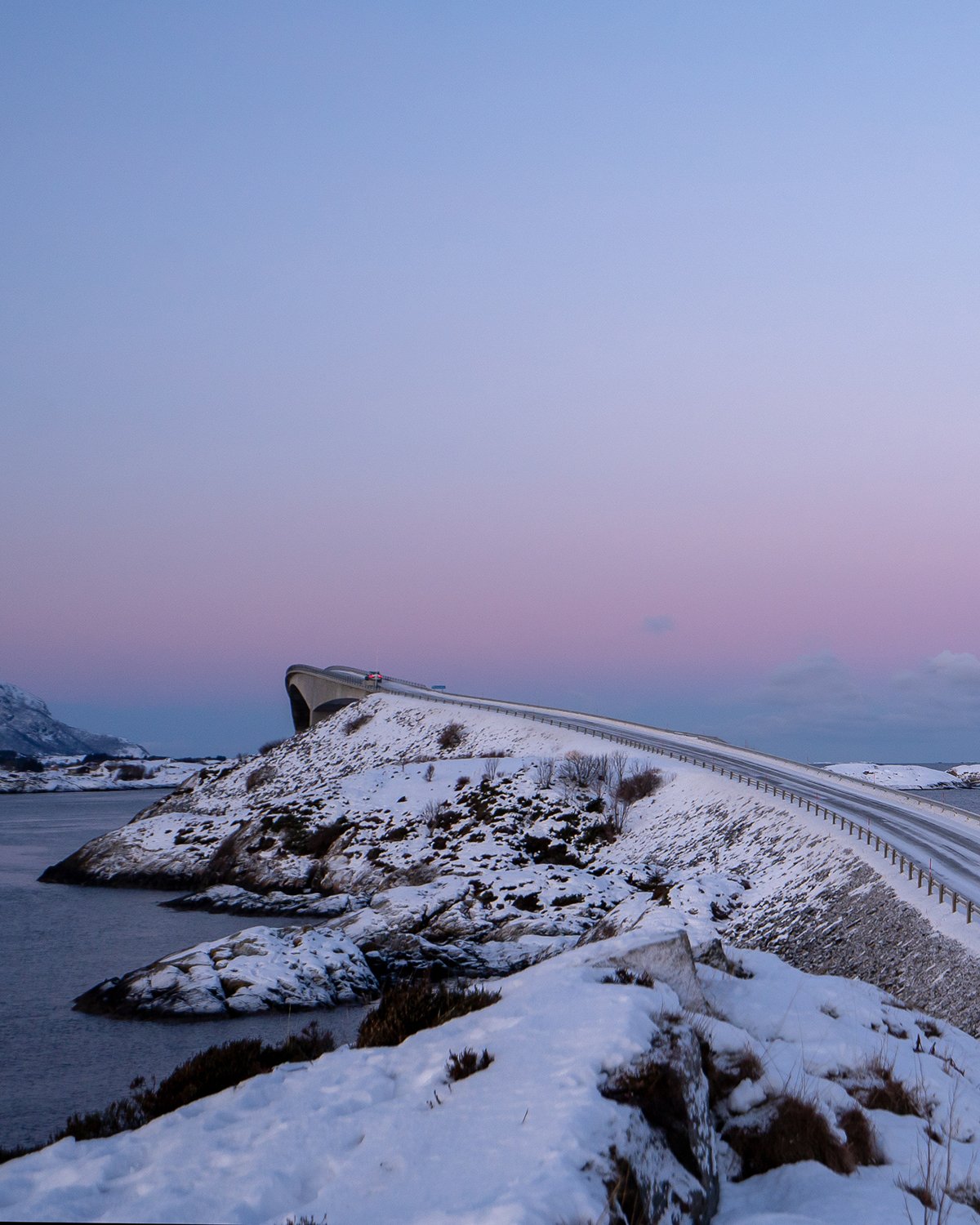
Photo 2 of 13: Sogge bru. Norwegian Scenic route Gerianger-Trollstigen. Photo: Jarle Wæhler, Statens vegvesen -

Photo 3 of 13: Trollstigvegen, Stigfossen. Norwegian Scenic Route Geiranger - Trollstigen. Photo: Jarle Wæhler, Statens vegvesen -

Photo 4 of 13: Trollstigen. Norwegian Scenic Route Geiranger - Trollstigen. Photo: Jarle Wæhler, Statens vegvesen -

Photo 5 of 13: Trollstigen-Valldal. Trollstigen. Norwegian Scenic Route Geiranger - Trollstigen. Photo: Jarle Wæhler, Statens vegvesen -

Photo 6 of 13: Meiadalen. Norwegian Scenic Route Geiranger - Trollstigen. Photo: Magne Flemsæter, Statens vegvesen -

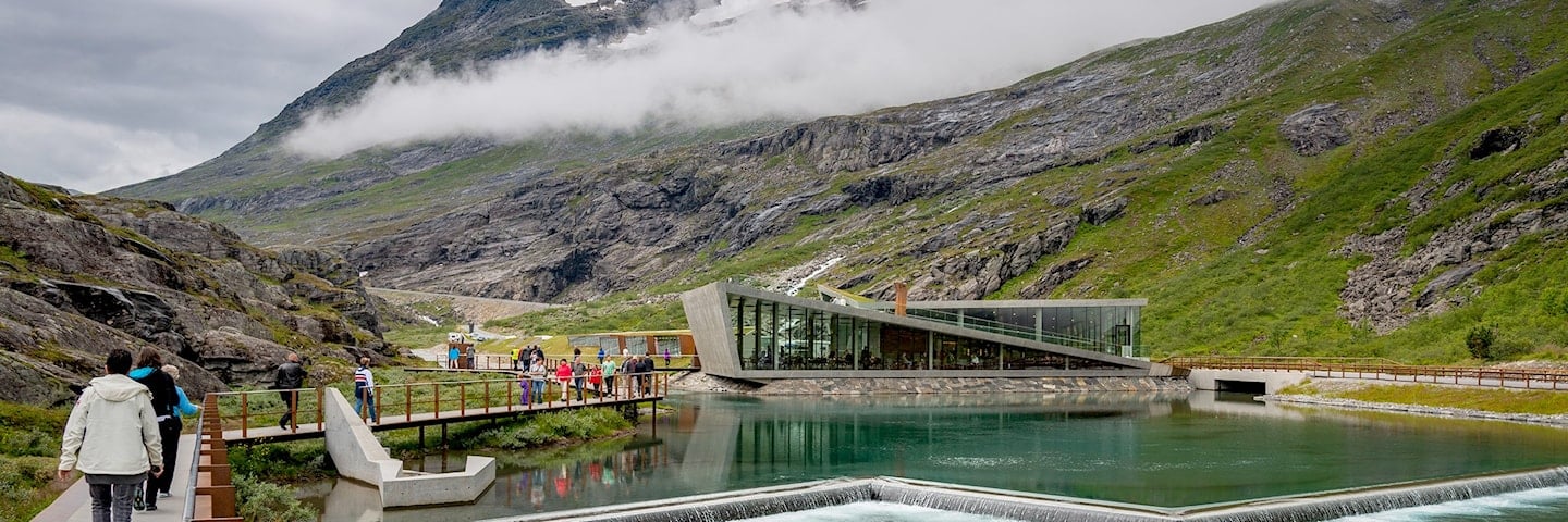
Photo 7 of 13: Gudbrandsjuvet. Norwegian Scenic Route Geiranger - Trollstigen. Photo: Roger Ellingsen, Statens vegvesen -

Photo 8 of 13: Linge. Norwegian Scenic Route Geiranger - Trollstigen. Photo: Roger Ellingsen, Statens vegvesen -

Photo 9 of 13: Valldal. Norwegian Scenic Route Geiranger - Trollstigen. Photo: Jarle Wæhler, Statens vegvesen -

Photo 10 of 13: Ørnesvingen, Geiranger. Norwegian Scenic Route Geiranger - Trollstigen. Photo: Jarle Wæhler, Statens vegvesen -

Photo 11 of 13: "Knuten", Geiranger. Norwegian Scenic Route Geiranger - Trollstigen. Photo: Jarle Wæhler, Statens vegvesen -

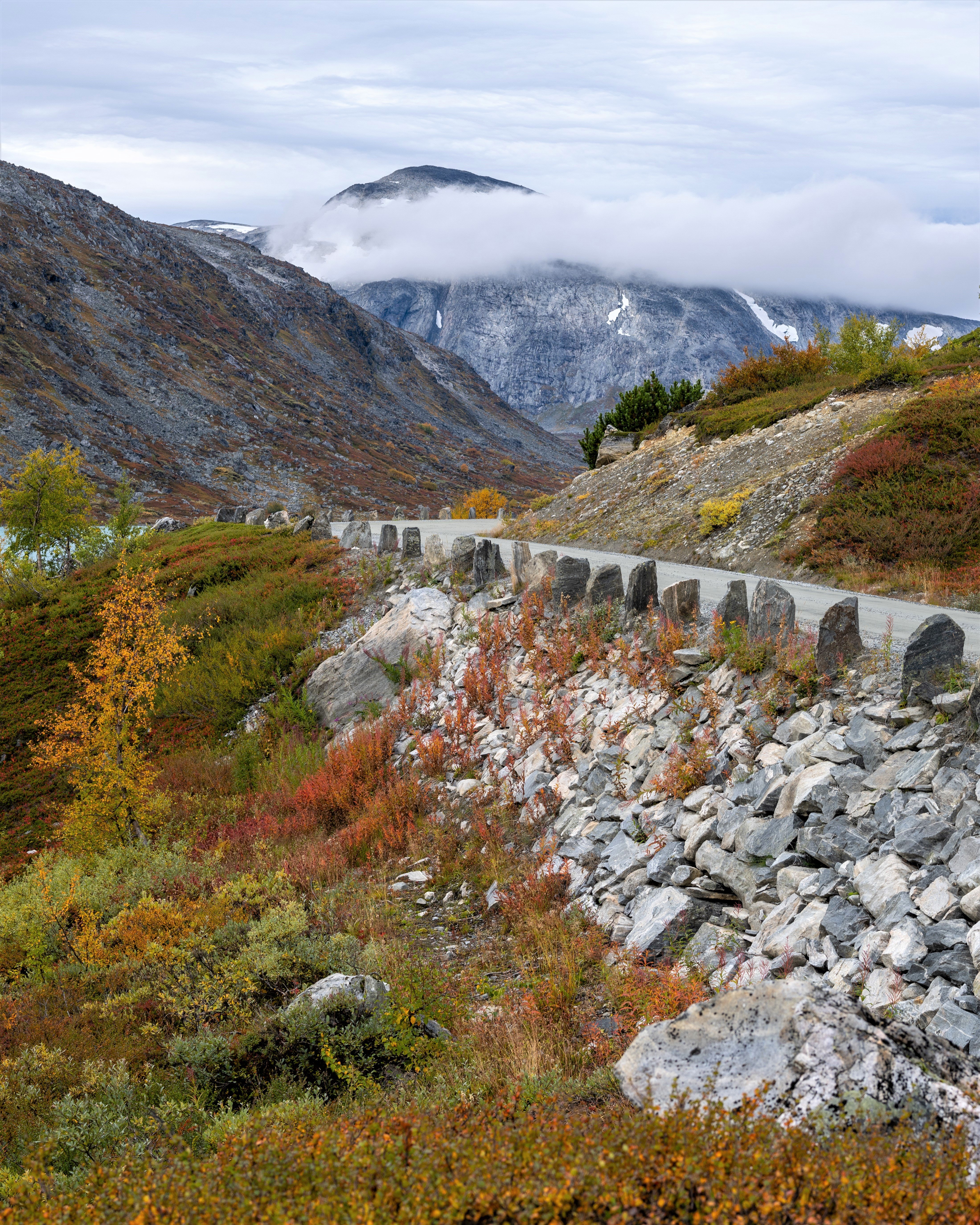
Photo 12 of 13: Kvanndalen. Norwegian Scenic Route Geiranger - Trollstigen. Photo: Roger Ellingsen, Statens vegvesen -

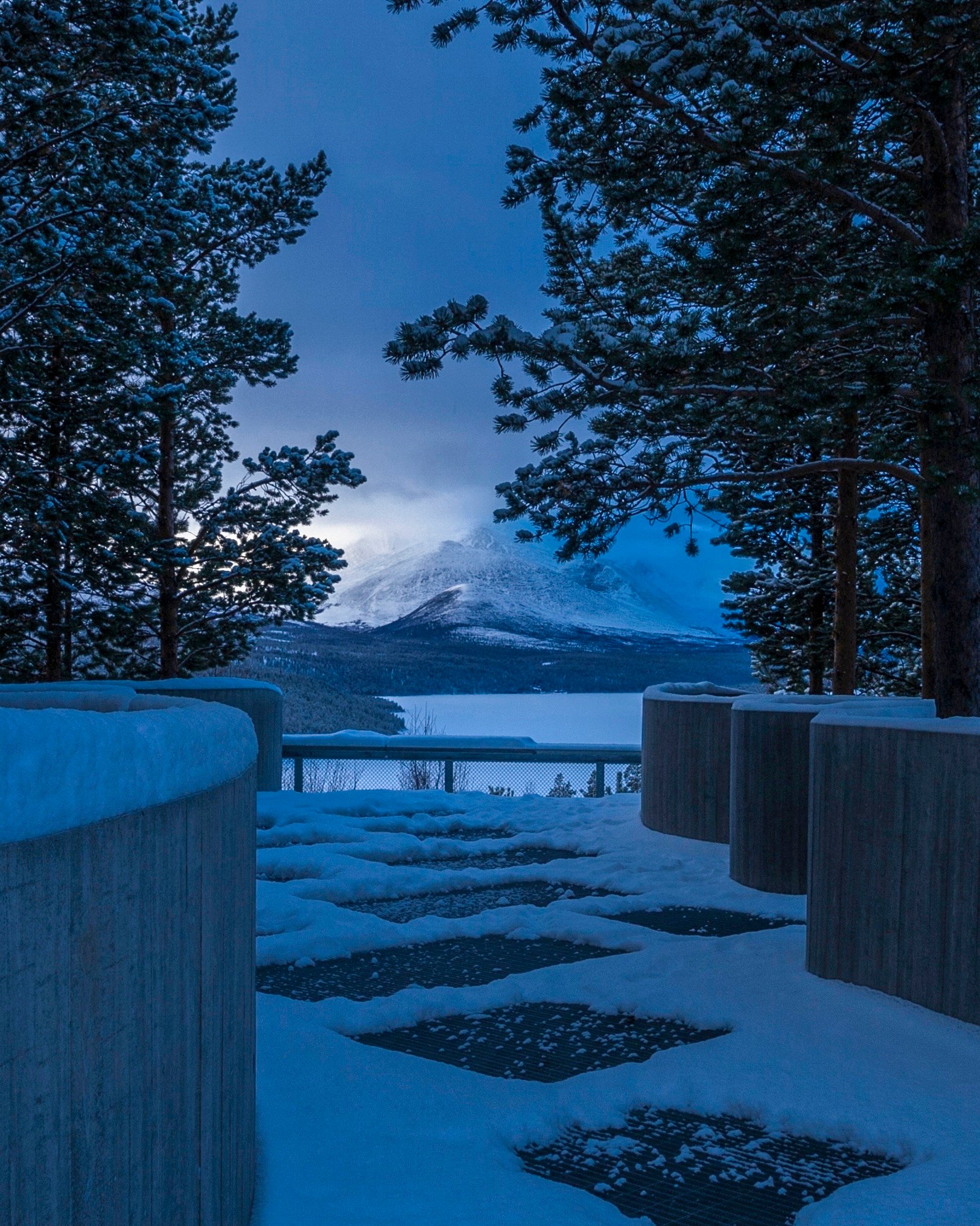
Photo 13 of 13: Djupvatnet. Norwegian Scenic Route Geiranger - Trollstigen. Photo: Roger Ellingsen, Statens vegvesen
Experiences
For centuries, the Trollstigen route has been important to travellers between Valldal and Åndalsnes. First as a trail, then as a bridleway, until the Trollstigvegen road was started in 1916. Parts of the original pack trail are still visible and passable on foot.
Taking the ferry on the fiord will bring you close to the famous waterfalls of Dei Sju Systre (“the Seven Sisters”), Friaren (“the Suitor”) and Brudesløret (“the Bride’s Veil”), while at the same time letting you experience the most famous fiord in the world, the Geiranger fiord, which is on UNESCO’s list of World Heritage Sites. You may include the ferry route between Geiranger and Hellesylt, as part of a round trip of the World Heritage area, or as part of the stretch from Geiranger to Trollstigen.
Norwegian Scenic Route Geiranger -Trollstigen provides a wealth of hiking options in an amazing and spectacular landscape of fiord and mountains. Another attractive but very steep hike is the hike up to the abandoned mountain farm of Skageflå, starting with a boat trip on the Geiranger fiord. The trail from Trollstigen up to Lake Bispevatnet offers a peaceful walk under the mighty mountains. At the foot of Trollstigen you can go for an easy circular walk along the cascading river.
Useful links
-
The official travel guide to Norway
-
Ferry routes and timetables (Norwegian)
-
Travel by bus, train, ferry, metro and plane
-
Good advice for campers
-
Plan your trip and familiarize yourself with the traffic rules in Norway
De 18 nasjonale turistvegene
Nasjonale turistveger er kjøreturer gjennom vakker norsk natur. Opplevelsen forsterkes med nyskapende arkitektur og tankevekkende kunst på tilrettelagte utsiktspunkter og rasteplasser.
![]()