Nasjonal turistveg Ryfylke
Along verdant fjords and stark mountains
A drive in the borderland between the archipelago and the highland moors, from Lysefjorden to Sauda and over the mountain pass to Røldal.
The drive along Scenic Route Ryfylke is a journey full of contrasts. Here you will encounter high barren mountains, lush hillsides, steep mountainsides and deep fiords. The Saudafjellet mountain displays distinctive natural features. It is rough, rugged and unyielding.
Since Ryfylke is a long and varied route, it is worth taking your time. There are lots of opportunities for short detours and breaks along the way, whether you are keen to find out more about Sauda’s industrial history or just want to explore one of the lovely little shore villages such as Sand.
Map of the route
Closed for the winter
- Closed:
- Estimated open:


Travel information
- Length
- 260 km
- MASL
- 0 – 972
- Sea crossing
- 2 ferries
Norwegian Scenic Route Ryfylke travels between Håra and Oanes at Lysefjorden [46] [520] [13] [523]. From Håra the tourist route splits into two sections. One section travels [13] down Brattlandsdalen and Suldalslågen with a small detour to Høse Bridge at Sand [4716]. The other section [520] [46] to Sauda, with a short detour to Ropeid rest area. The road sections meet after crossing the Sandsfjord Bridge - creating a round trip. The route has one ferry crossing: Nesvik to Hjelmeland (click on the ferry icon for timetable) and Lauvvika to Oanes.
For syclists: Starting from Håra near Røldal, you will have a steep climb up toward Saudafjellet. Avoid tunnels along Saudafjorden by cycling along the old road on the outside. Between Ropeid and Ostasteidn, you have to ride through a tunnel that is approximately 1 km long. From Håra to Lovra, the route includes many long tunnels where there is no alternative outside route.
Combine this trip with National Cycle Route 2, which includes the road from Stavanger to Lysebotn. From Stavanger you can also follow National Cycle Route 1 along the coast. This stretch is also part of the European “North Sea Cycle Route” EuroVelo 12.
Veg og trafikkinformasjon
Map information
- GPS, Oanes:
- 58.914264, 6.077564
- GPS, Håra:
- 59.8138, 6.773779
Gpx file download for gps and navigation app.
In this file, the direction of travel is from Oanes over Rødalsfjellet to Håra and Lovraeidet. Gpx files for all Scenic Routes. Any alternative driving pattern must be adapted by the users themselves.
Information
Emptying toilets from motorhomes and caravans is not permitted in our toilets. The facility is not designed for such use. The nearest dump stations are at Sauda and Sand.
Vinterinformasjon
The road between Helandsbygd and Røldal [520] is closed in Winter. Previous closures are 21 November and 20 December. Previous openings are 1 May and 16 June. NOTE! After opening, the road may be closed for a period at night and in bad weather. Click on the snow icon in the map for information about closures.
Road condition
Sections of the road, particularly over the mountain to Røldal, are narrow with a number of bends. There is currently no maximum limit for the length of buses, however, we would recommend a shorter length.
-

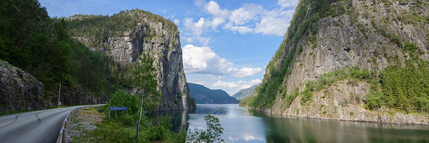
Photo 1 of 11: Suldalsporten, Suldalsvatnet. Photo: Fredrik Fløgstad, Statens vegvesen -

Photo 2 of 11: Svartavatnet. Photo: Roger Ellingsen, Statens vegvesen -

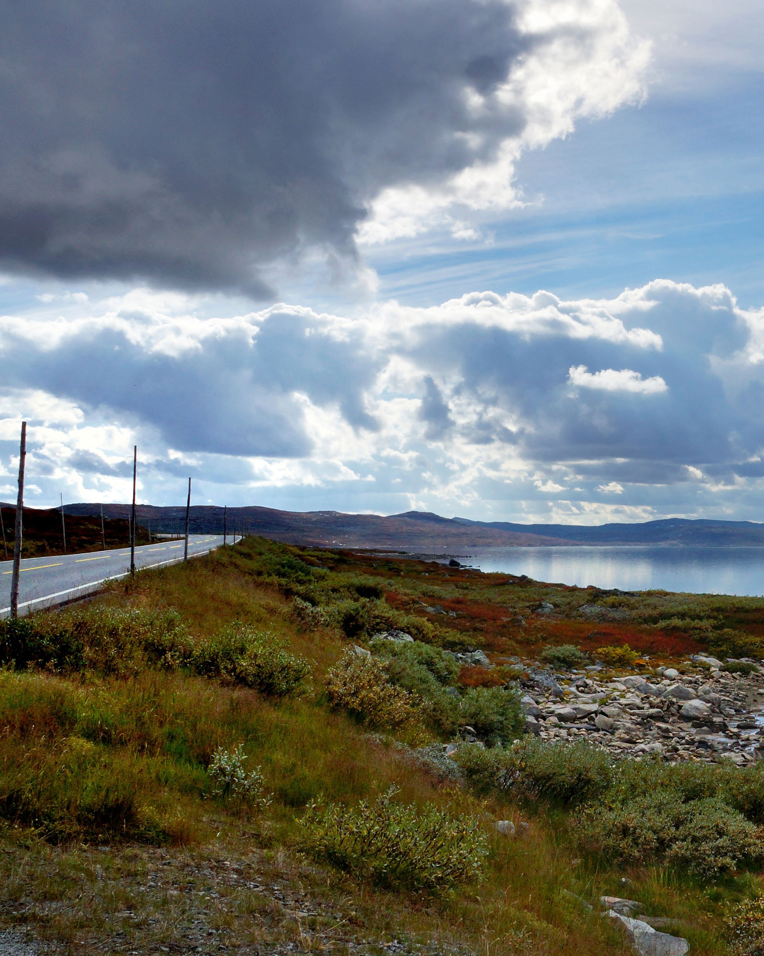
Photo 3 of 11: Fv. 520 Røldal - Sauda. Photo: Frid-Jorunn Stabell, Statens vegvesen -

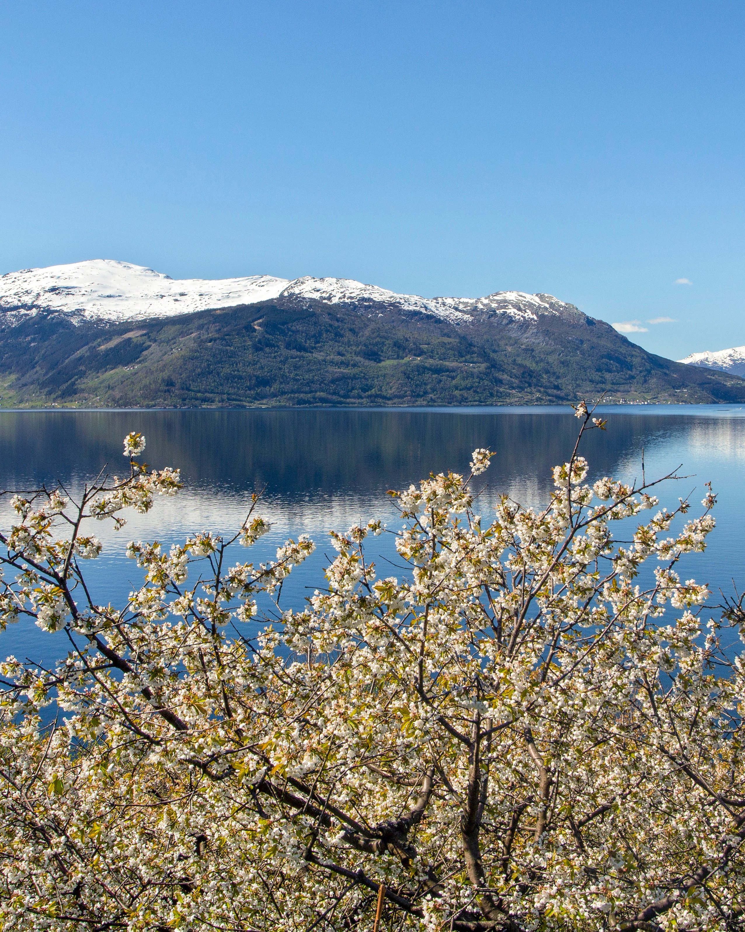
Photo 4 of 11: Suldalsvatnet. Photo: Jarle Wæhler, Statens vegvesen -

Photo 5 of 11: Fv. 520 Røldal - Sauda. Photo: Frid-Jorunn Stabell, Statens vegvesen -

Photo 6 of 11: Svandalsfossen. Photo: Steinar Skaar, Statens vegvesen -

Photo 7 of 11: Svandalsfossen. Photo: Helge Stikbakke, Statens vegvesen -

Photo 8 of 11: Suldalsosen. Photo: Frid-Jorunn Stabell, Statens vegvesen -

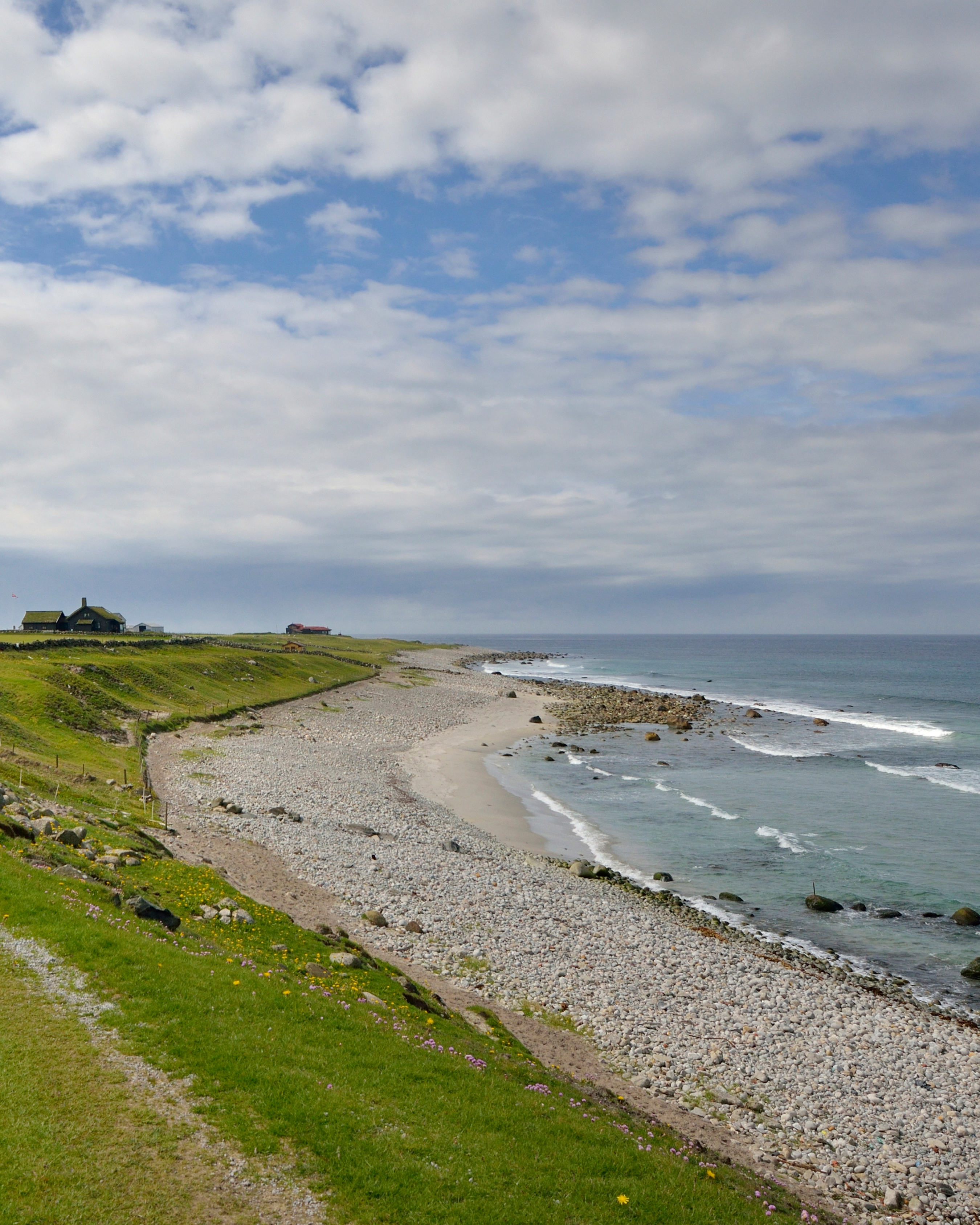
Photo 9 of 11: Hjelmeland. Photo: Werner Harstad, Statens vegvesen -

Photo 10 of 11: Hjelmelandsfjorden. Photo: Fredrik Fløgstad, Statens vegvesen -

Photo 11 of 11: Røldal - Sauda. Photo: Jarle Wæhler, Statens vegvesen
Experiences
Many tourists find their way to Ryfylke. The area is home to some of the most spectacular nature attractions Norway has to offer. Preikestolen (“Pulpit Rock”) and Kjeragbolten, with the Lysefjord in the background, are both popular as hiking destinations and photgraphic motifs. But the area also has many other unique hiking destinations that are little known.
On sunny days you should consider hiking to Reinaknuten and Skomakernibå. From both tops you will have an impressive view of large parts of Ryfylke, including Lake Tysdalsvatnet and Jøsenfjorden.
The circular trail to Ritlandskrateret - the Ritland Crater - is a unique experience where you take in the crater of a meteor that hit the Earth 500-600 million years ago. You can also hike to Hovlandsnuten near Sauda. Here, sherpas from Nepal have built solid stone steps to facilitate the walk.
There are two short ferry rides on this route where you can enjoy a breath of fresh sea air and admire the fiords up close.
Useful links
-
The official travel guide to Norway
-
Ferry routes and timetables (Norwegian)
-
Travel by bus, train, ferry, metro and plane
-
Good advice for campers
-
Plan your trip and familiarize yourself with the traffic rules in Norway
De 18 nasjonale turistvegene
Nasjonale turistveger er kjøreturer gjennom vakker norsk natur. Opplevelsen forsterkes med nyskapende arkitektur og tankevekkende kunst på tilrettelagte utsiktspunkter og rasteplasser.
![]()