Nasjonal turistveg Varanger

The road to the Arctic Ocean
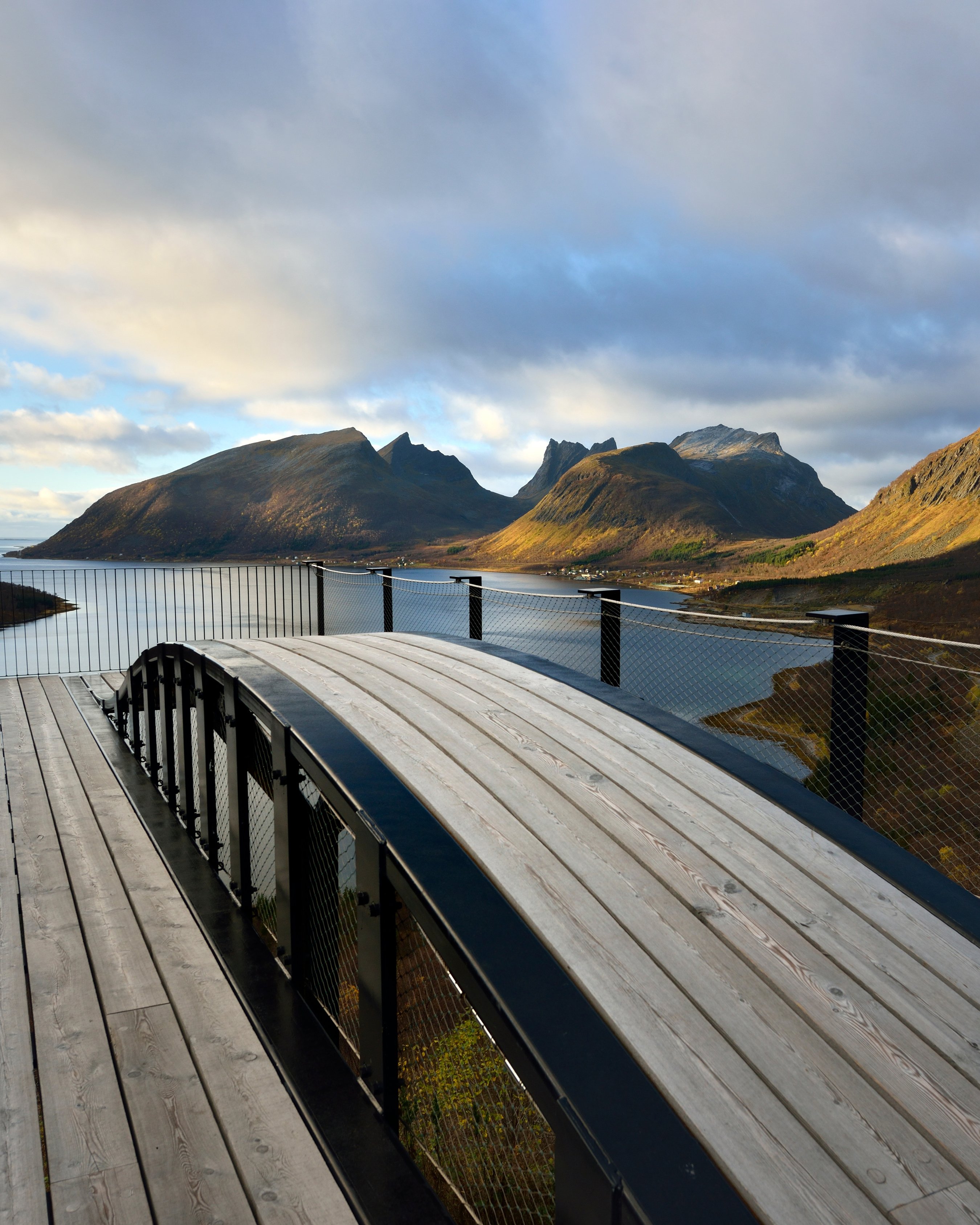
A drive in the fluctuating light of the ocean and sky – towards the expanse of ocean and unique rock landscape.
Varanger is about the long lines in the landscape, as well as the long lines of history. Proximity to Russia, Finnish immigration and Sami traditions provide the area with exciting cultural diversity.
The drive runs through birch woods, marshland and a rugged cliff landscape. The light is special and the birdlife and wildlife unique. Species of birds that you won’t find anywhere else in the world are relatively easily accessible. There is also a good chance of experiencing reindeer at first hand along this road.
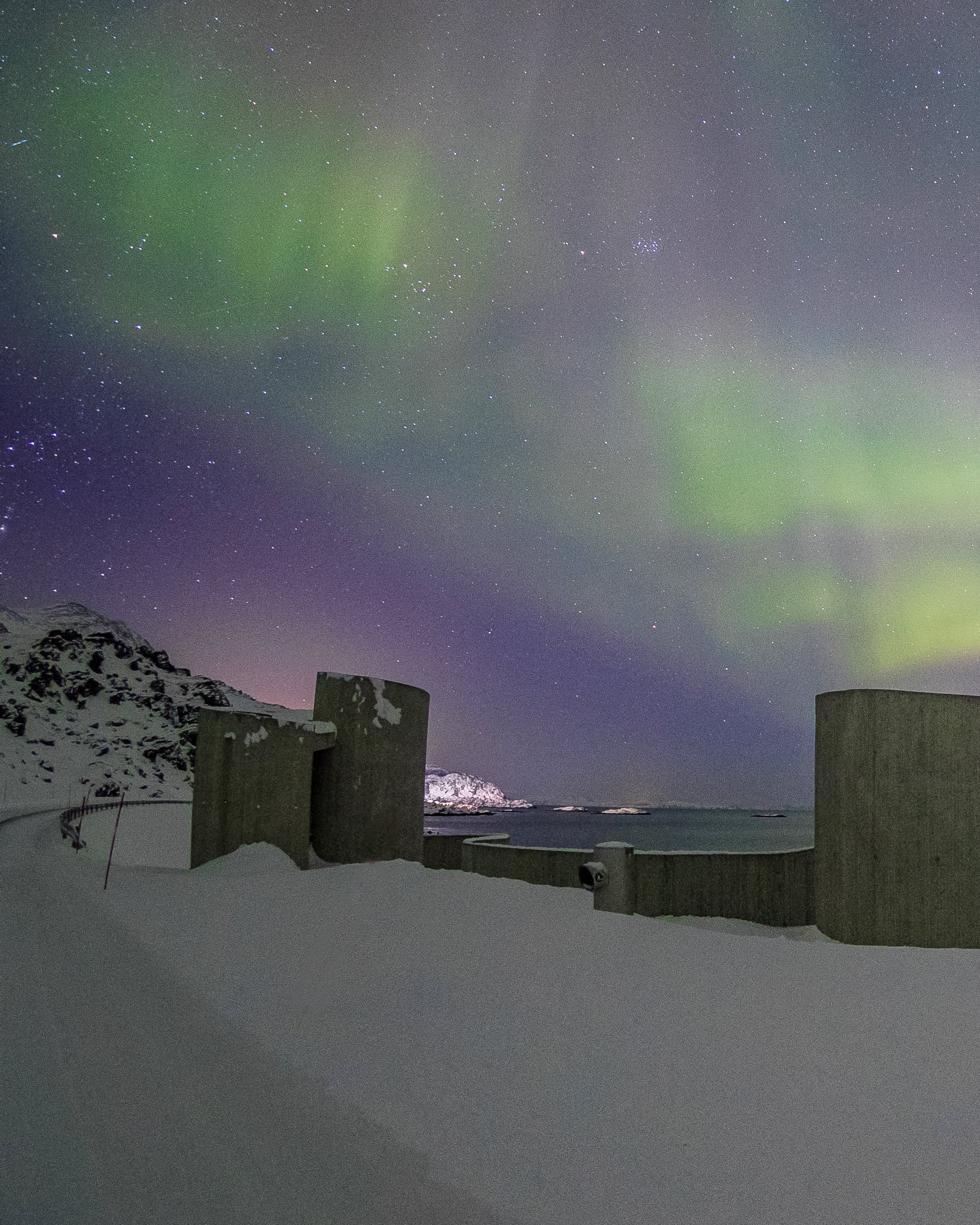
The route will reveal natural surroundings full of contrasts, and the lunar landscape out towards Hamningberg in many ways makes your drive feel like a journey to the end of the world.
Map of the route
Closed for the winter
- Closed:
- Estimated open:


Travel information
- Length
- 160 km
- MASL
- 0 – 123
Norwegian Scenic Route Varanger runs from Varangerbotn [75] to Hamningberg [8100]. Experience one of Norway’s most beautiful round trips by combining this route with the Hurtigruten coastal express and Norwegian Scenic Route Havøysund.
For cyclists: The scenic route is a relatively easy but long bike ride along Varangerfjorden, with Varangerbotn as the recommended starting point. Note that the road to Vardø requires you to go through an underwater tunnel. The ride out to Hamningberg runs through a hilly landscape.
Veg og trafikkinformasjon
Map information
- GPS, Hamningberg:
- 70.539972, 30.607588
- GPS, Varangerbotn:
- 70.173942, 28.567617
Gpx file download for gps and navigation app.
In this file, the direction of travel is from Varangerbotn to Hamningberg. Gpx files for all Scenic Routes. Any alternative driving pattern must be adapted by the users themselves.
Information
Emptying toilets from motorhomes and caravans is not permitted in our toilets. The facility is not designed for such use. The nearest dump station is at Vadsø.
Vinterinformasjon
The road between Smelror and Hamningberg is closed in winter. Previous closures are 4 November and 22 December. Previous openings are 18 April and 25 May.
NOTE! After opening, the road may be closed for a period at night and in bad weather. Click on the snow icon in the map for information about closures.
Road condition
The road between Svartnes and Hamningberg is narrow with a number of bends.
-

Photo 1 of 11: Skallelv. Norwegian Scenic Route Varanger. Photo: Jarle Wæhler, Statens vegvesen -

Photo 2 of 11: Skallelv. Norwegian Scenic Route Varanger. Photo: Jarle Wæhler, Statens vegvesen -

Photo 3 of 11: Reindeer, Langbubukta. Norwegian Scenic Route Varanger. Photo: Jarle Wæhler, Statens vegvesen -

Photo 4 of 11: Ekkerøya. Norwegian Scenic Route Varanger. Photo: Bjarne Riesto, riesto.no -

Photo 5 of 11: Vardø. Norwegian Scenic Route Varanger. Photo: Øyvind Antonsen -

Photo 6 of 11: Hamningberg. Norwegian Scenic Route Varanger. Photo: Roger Ellingsen, Statens vegvesen -

Photo 7 of 11: Hamningberg. Norwegian Scenic Route Varanger. Photo: Asbjørn Nilsen -

Photo 8 of 11: Kiberg. Norwegian Scenic Route Varanger. Photo: Asbjørn Nilsen -

Photo 9 of 11: Stellerand, Kiberg. Norwegian Scenic Route Varanger. Photo: Tormod Amundsen, Biotope.no -

Photo 10 of 11: Hamningberg. Norwegian Scenic Route Varanger. Photo: Fredrik Fløgstad, Statens vegvesen -

Photo 11 of 11: Ekkerøya Norwegian Scenic Route Varanger. Photo: Øyvind Antonsen
Experiences
The weather in the Arctic climate zone is an experience in itself; in one day you may experience four different seasons. In summer, Siberian heat may suddenly be replaced by an icy sea fog; in winter, violent storms rage along the coastline.
Varanger is one of northern Europe's richest bird areas. Take the time to observe the rare bird species. Along this route, several bird-watching hides have been built where you can sit well sheltered against the vagaries of the weather while you enjoy the landscape. After visiting the Steilneset Memorial you should drop by the picturesque Vardøhus Fortress, situated at the easternmost point of Norway.
Nature in Varanger is rugged and desolate, with unique landscape formations that provide a powerful backdrop for your hiking experience. Large areas consist of terrain that is easy to walk, but you should remember that the climate here is partly Arctic and the weather can change rapidly.
For bird enthusiasts we recommend the islands of Ekkerøya and Hornøya with their rich birdlife, or the bird trail in Komagdalen, which is located within Varangerhalvøya National Park.
Useful links
-
The official travel guide to Norway
-
Travel by bus, train, ferry, metro and plane
-
Good advice for campers
-
Plan your trip and familiarize yourself with the traffic rules in Norway
De 18 nasjonale turistvegene
Nasjonale turistveger er kjøreturer gjennom vakker norsk natur. Opplevelsen forsterkes med nyskapende arkitektur og tankevekkende kunst på tilrettelagte utsiktspunkter og rasteplasser.
![]()