Nasjonal turistveg Sognefjellet
Above the roof of Norway
The Scenic Route travels from the cultural landscape in Lom across the highest mountain pass in Norway to the innermost part of Sognefjorden.
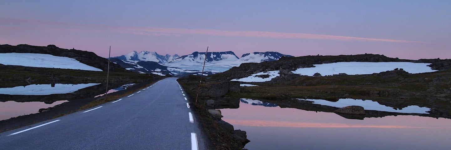
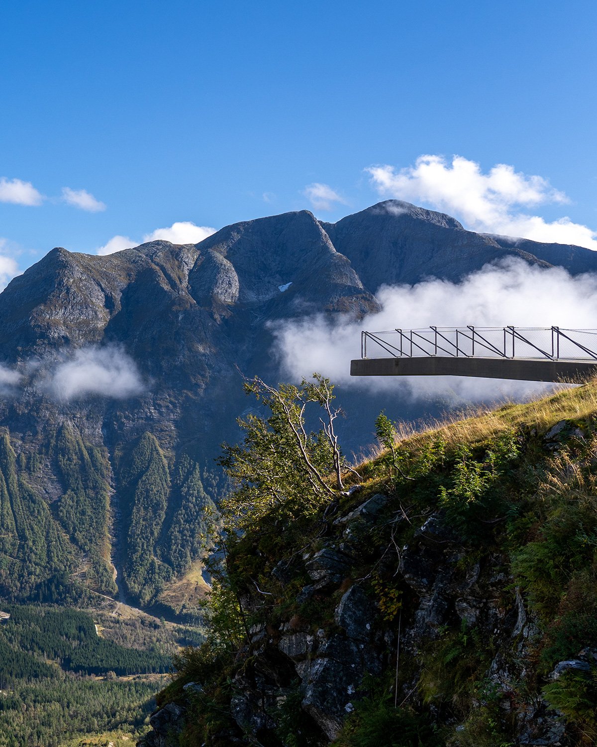
The gateway to Jotunheimen has long traditions as a thoroughfare. From the verdant meadows and lush cultural landscape of Bøverdalen, you can vaguely see the mighty mountains in the far distance. The road climbs gently up through the valley. It makes its way up to the summit 1434 metres above sea level, making this road the highest mountain pass in northern Europe.
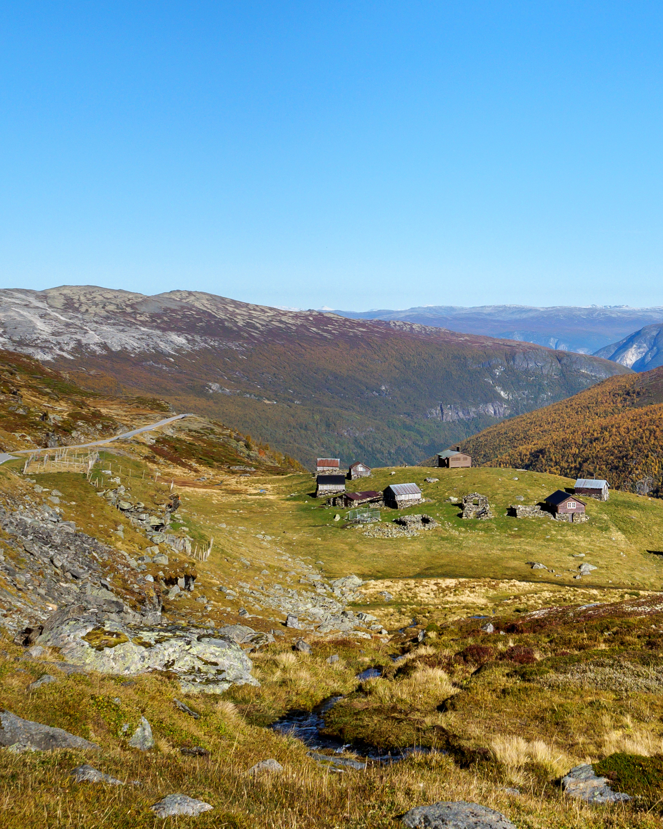
Continuing down towards Sognefjorden, the mountain area appears untamed. Towards Gaupne, the road runs down along the beautiful Sognefjorden whose clear waters change colour from green to blue in tune with the light and the weather.
Map of the route
Closed for the winter
- Closed:
- Estimated open:


Travel information
- Length
- 108 km
- MASL
- 0 – 1434
Norwegian Scenic Route Sognefjellet runs between Lom and Gaupne [55].
For cyclists: Sognefjellet is a spectacular bike ride, with Lom as the recommended starting point. Note that the route includes challenging climbs and a steep downhill ride to Fortun. The route coincides with National Cycle Route 6, which is planned between Røros and Hardanger. The part of the route that runs along Lustrafjorden is signposted.
Veg og trafikkinformasjon
Map information
- GPS, Lom:
- 61.831129, 8.554187
- GPS, Gaupne:
- 61.395127, 7.303172
Gpx file download for gps and navigation app.
In this file, the direction of travel is from Gaupne to Lom. Gpx files for all Scenic Routes. Any alternative driving pattern must be adapted by the users themselves.
Information
Emptying toilets from motorhomes and caravans is not permitted in our toilets. The facility is not designed for such use. The nearest dump stations are at Vågåmo, Lom and Gaupne.
Vinterinformasjon
The road over the mountain between Rustasætre/Vegaskjelet and Turtagrø is closed in winter. Previous closures are between 17 November and 17 December. Previous openings are between 12 April and 1 May. NOTE! After opening, the road may be closed for a period at night and in bad weather. Click on the snow icon in the map for information about closures.
-

Photo 1 of 11: Lom. Photo: Werner Harstad, Statens vegvesen -

Photo 2 of 11: Bøvertunvatnet, Lom. Photo: Werner Harstad, Statens vegvesen -

Photo 3 of 11: Bøvertunvatnet. Photo: Werner Harstad, Statens vegvesen -

Photo 4 of 11: Krossbu. Photo: Roger Ellingsen, Statens vegvesen -
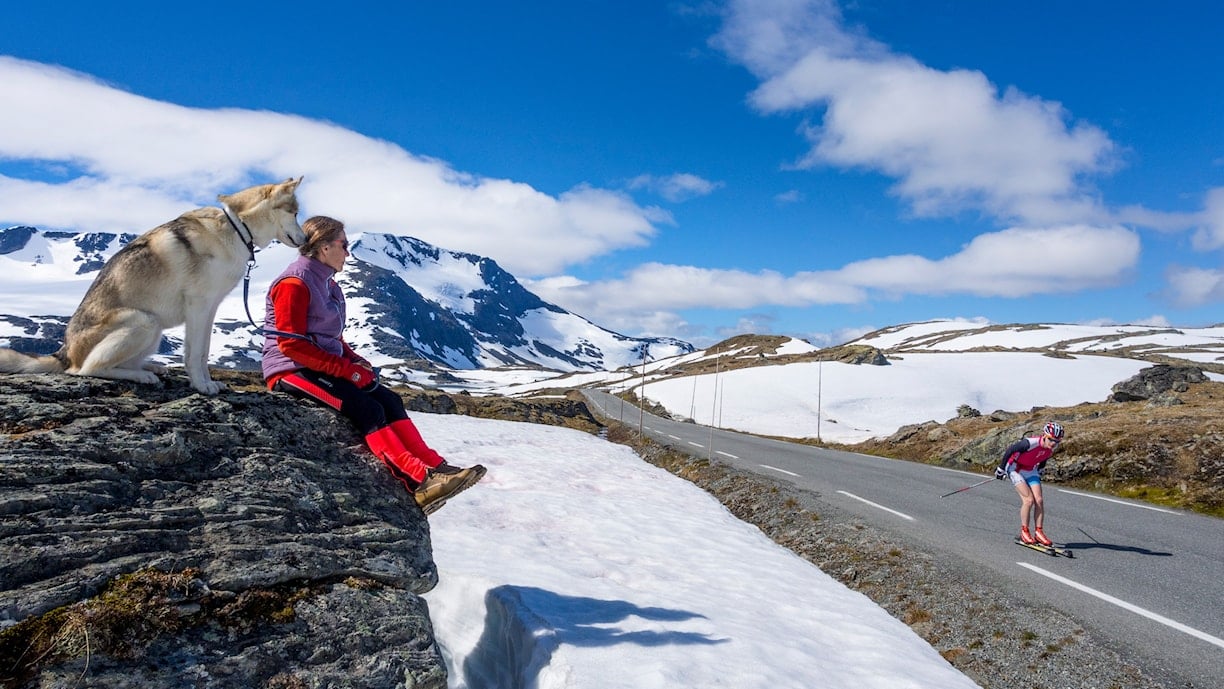
Photo 5 of 11: Sognefjellet. Photo: Werner Harstad, Statens vegvesen -

Photo 6 of 11: Sognefjellet. Photo: Jarle Wæhler, Statens vegvesen -

Photo 7 of 11: Sognefjellshytta. Photo: Werner Harstad, Statens vegvesen -

Photo 8 of 11: Sognefjellet. Photo: Jarle Wæhler, Statens vegvesen -

Photo 9 of 11: Oscarshaug. Photo: Frid-Jorunn Stabell, Statens vegvesen -

Photo 10 of 11: Dale, Luster. -

Photo 11 of 11: Luster. Photo: Frid-Jorunn Stabell
Experiences
Lom Stave Church is well worth a visit, and is a good place to mark the start or end of your trip. Lom has become a kind of culinary hub in Norway and there are many opportunities to have a good meal with local ingredients and delicious tastes.
Hiking options in Jotunheimen are endless, and almost regardless of where you stop, you will find alternatives to suit everyone. At the highest point of the route, you can follow the old waymarked Cairn Track (“Vardestien”) from Krossbu to Turtagrø, or walk along the Mefjell Track (“Mefjellstien”), starting at the stone sculpture.
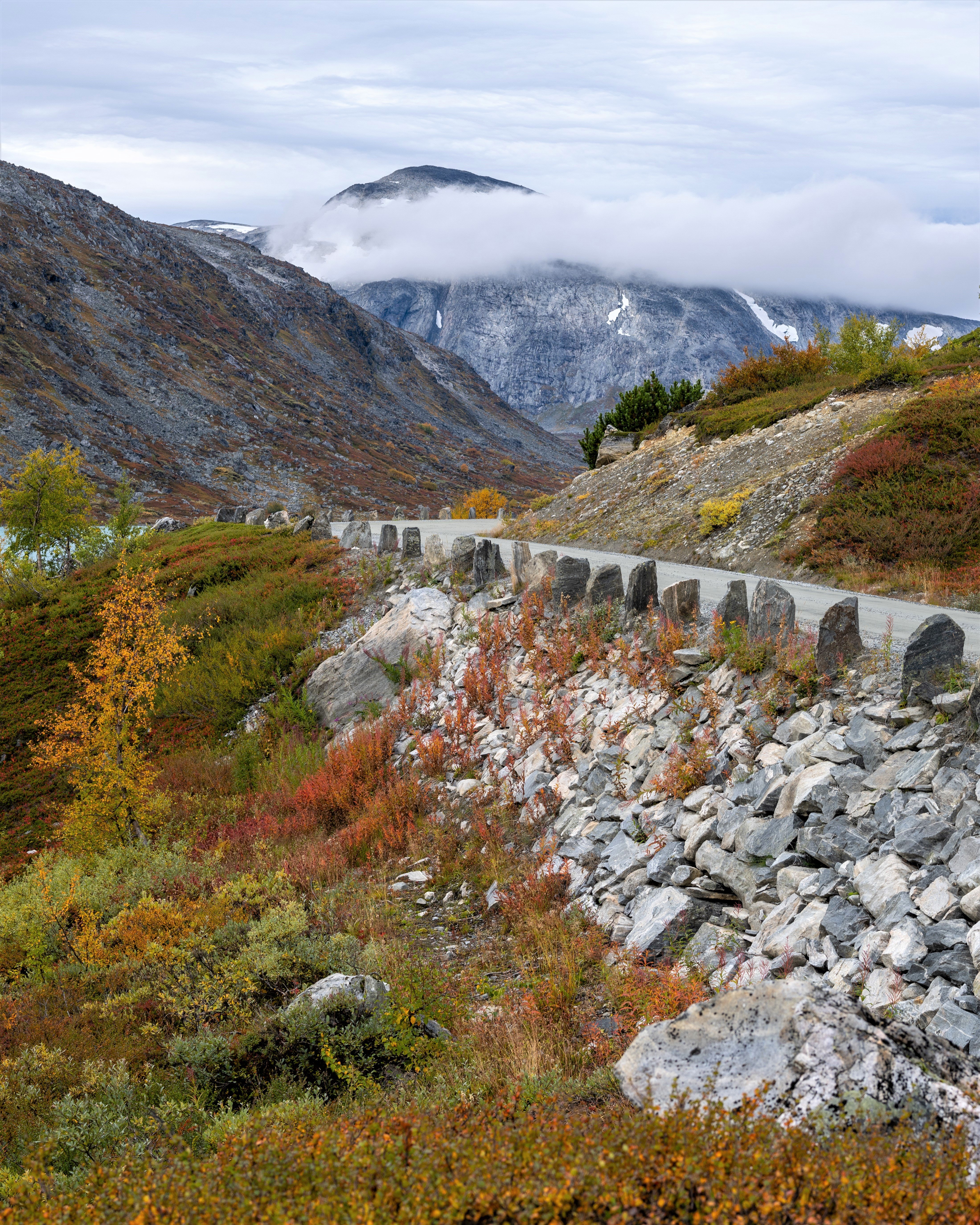
On your way down towards Turtagrø you will be driving past Fannaråken and Helgedalsnosi. These peaks offer breathtaking views of the wildest mountains in Norway - as many as 23 peaks above 2000 m asl. If you prefer lush hills to the bare mountain landscape, there are many hiking options in the Fortunsdalen valley, winding its way in between the high mountains.
Useful links
-
The official travel guide to Norway
-
Travel by bus, train, ferry, metro and plane
-
Good advice for campers
-
Plan your trip and familiarize yourself with the traffic rules in Norway
De 18 nasjonale turistvegene
Nasjonale turistveger er kjøreturer gjennom vakker norsk natur. Opplevelsen forsterkes med nyskapende arkitektur og tankevekkende kunst på tilrettelagte utsiktspunkter og rasteplasser.
![]()