Nasjonal turistveg Aurlandsfjellet
The snow road between the fjords
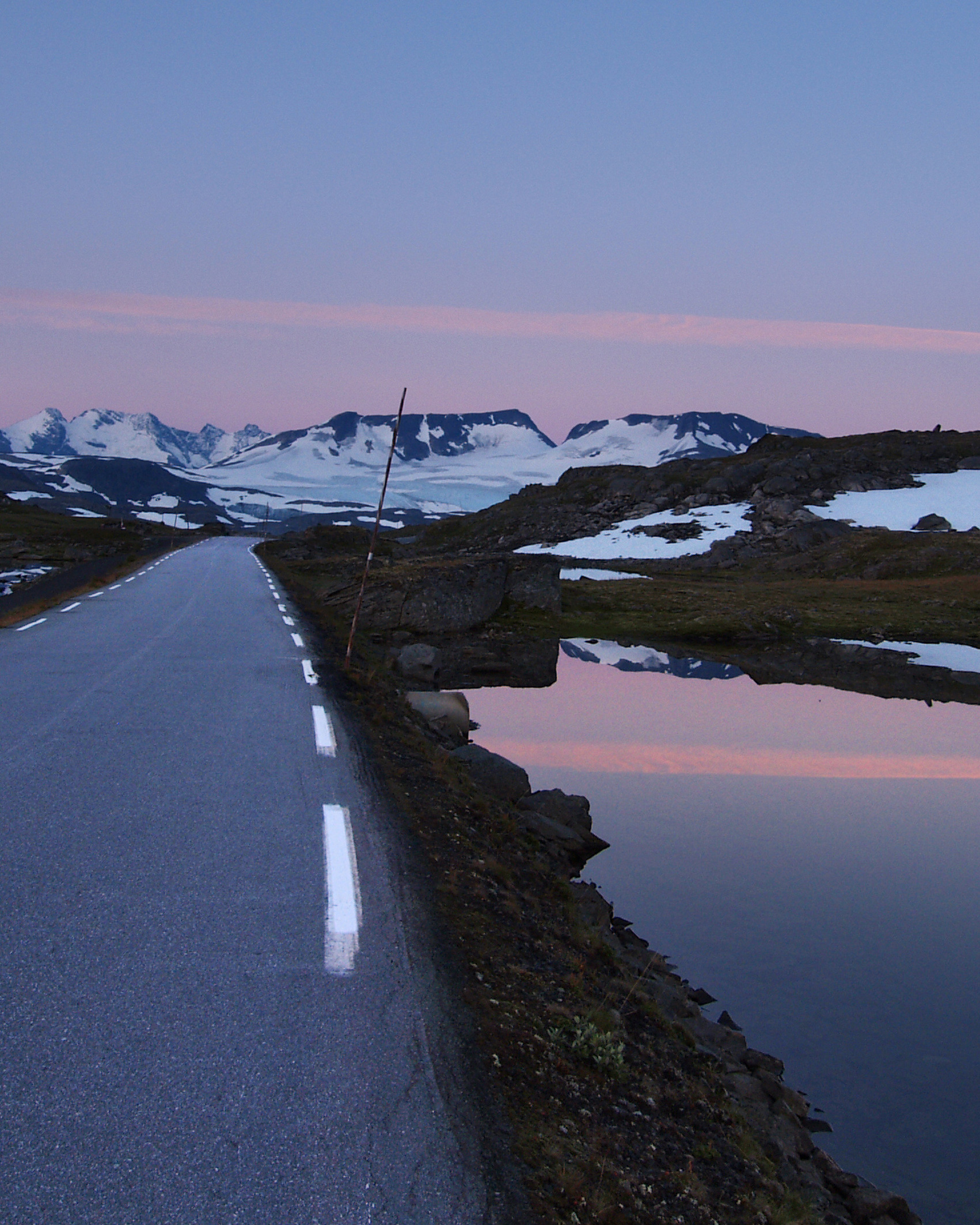
From fjord to fjord across a barren mountain noticeably marked by the snow, and with the view of Aurdalsfjorden as the grand finale.
This scenic route will give you many powerful impressions, and the contrasts are compelling between the fiord and the high mountain where there is snow on the ground most of the year. One of the most characteristic features of this route is the desolate and apparently completely untouched landscape it runs through. The exception is the power line, which bears witness to the presence of human beings.
Combined with the Lærdal Tunnel, this makes a unique circular trip from Gamle Lærdalsøyri to Aurlandsvangen. The road is closed in winter, but the stretch from Aurlandsvangen is open as far as the viewpoint at Stegastein all year round.
Map of the route
Closed for the winter
- Closed:
- Estimated open:


Travel information
- Length
- 47 km
- MASL
- 0 – 1308
Norwegian Scenic Route Aurlandsfjellet runs between Lærdalsøyri and Aurlandsvangen [5627]. Driving through the Lærdal Tunnel, the world’s longest road tunnel with a length of 24.5 km, will allow you to enjoy a wonderful round trip.
For cyclists: Aurlandsfjellet can be a demanding cycle ride with a long climb up the mountain whether you start from Lærdal or from Aurland. The stretch from Stegastein towards Aurlandsfjorden may have a lot of traffic in the summer.
Veg og trafikkinformasjon
Map information
- GPS, Lærdalsøyri:
- 61.101395, 7.460039
- GPS, Aurlandsvangen:
- 60.910982, 7.191303
Gpx file download for gps and navigation app.
In this file, the direction of travel is from Aurlandsvangen to Lærdalsøyri. Gpx files for all Scenic Routes. Any alternative driving pattern must be adapted by the users themselves.
Information
Emptying toilets from motorhomes and caravans is not permitted in our toilets. The facility is not designed for such use.
Vinterinformasjon
The road over the mountain is closed in winter. Previous closures are 07 October and 6 November. Previous openings are 7 May and 3 June. The road from Aurlandsvangen to the viewpoint Stegastein is open all year round. NOTE! After opening, the road may be closed for a period at night and in bad weather. Click on the snow icon in the map for information about closures.
Road condition
There are restrictions on the length of buses and the maximum length is 12,4 metres.
-

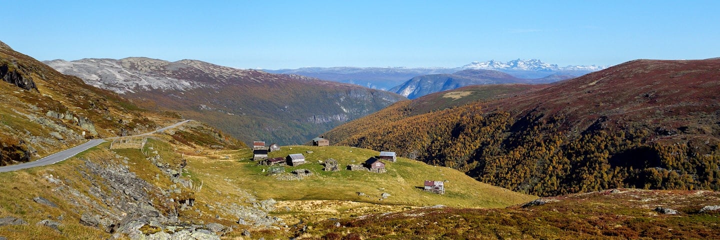
Photo 1 of 11: Kvammadalen. Photo: Roger Ellingsen, Statens vegvesen -

Photo 2 of 11: Vedahaugane. Photo: Roger Ellingsen, Statens vegvesen -

Photo 3 of 11: Vedahaugane. Photo: Therese Ruud, Statens vegvesen -

Photo 4 of 11: Flotane. Photo: Jarle Wæhler, Statens vegvesen -

Photo 5 of 11: Flyvotni. Photo: Bjørn Andresen, Statens vegvesen -

Photo 6 of 11: Flotane. Photo: Therese Ruud, Statens vegvesen -

Photo 7 of 11: Flotane. Photo: Jarle Wæhler, Statens vegvesen -

Photo 8 of 11: Erdalselvi, Sluppen. Photo: Therese Ruud, Statens vegvesen -

Photo 9 of 11: Lærdalsøyri. Photo: Jarle Wæhler, Statens vegvesen -

Photo 10 of 11: Skålane. Photo: Therese Ruud, Statens vegvesen -

Photo 11 of 11: Erdalen. Photo: Jarle Wæhler, Statens vegvesen
Experiences
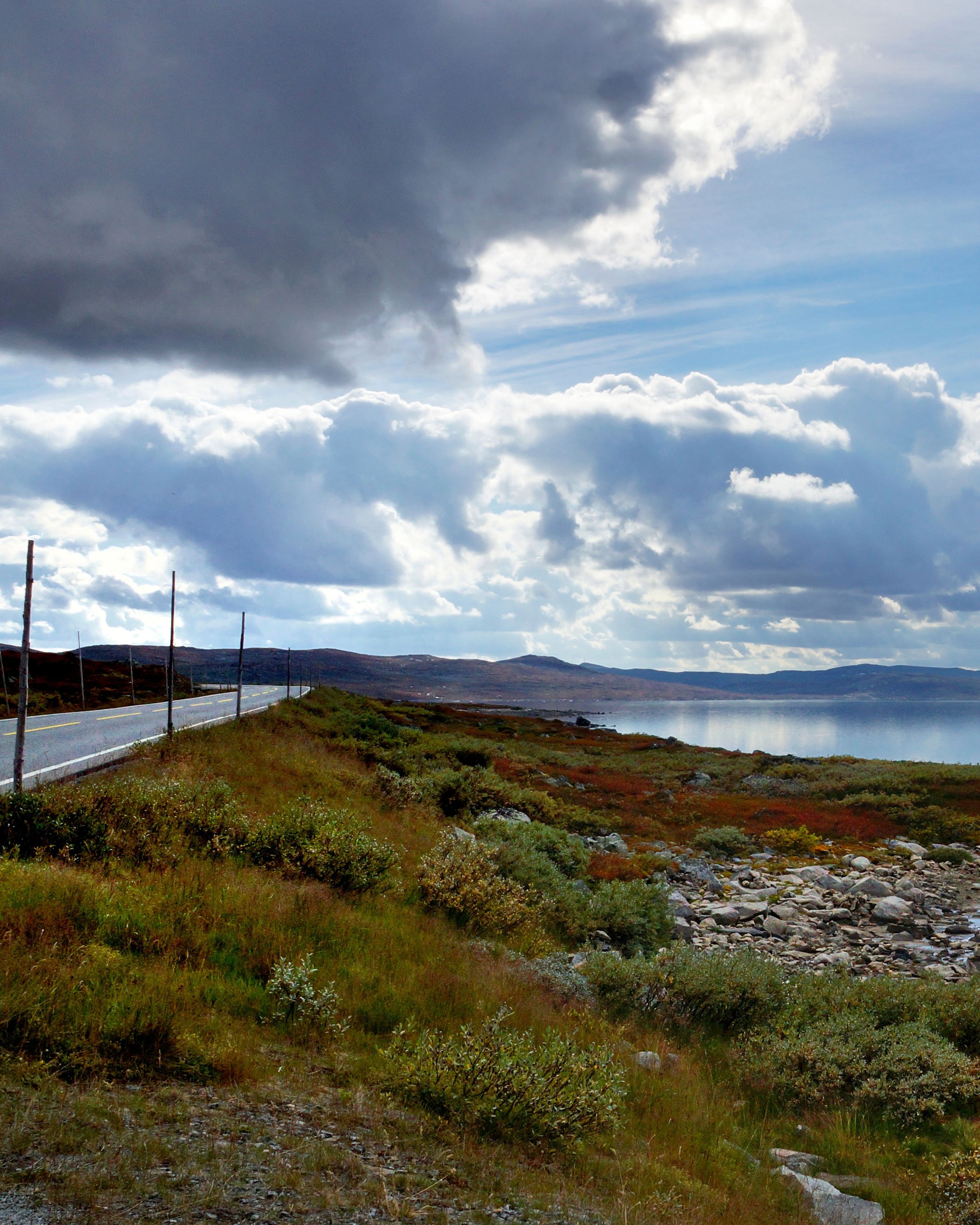
What is often found to leave the strongest impression on visitors at Aurlandsfjellet is the feeling of being somewhere where there are few traces of human beings. Here the quality lies in the little things, such as touching the snow or dipping your toes in an ice-cold mountain lake. The desolate landscape is quite unique. The route runs from the fiord to the mountain, from the lush valley to the rocky high-mountain desert.
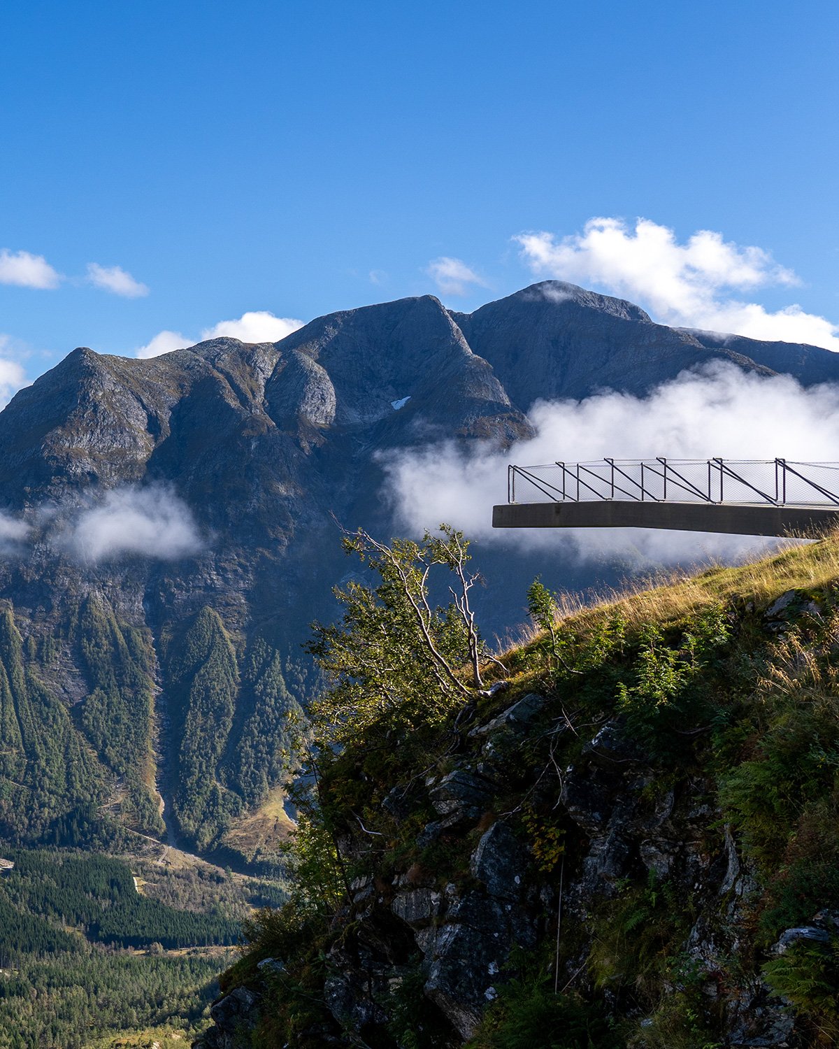
The "snow road" over Aurlandsfjellet offers many and strong contrasts, and the viewpoint of Stegastein is a natural place to stop on your way down from the mountain. The road between Aurlandsvangen on Aurlandsfjorden and Lærdalsøyri on Sognefjorden is an excellent starting point for great hikes with magnificent views of the fiords.
Useful links
-
The official travel guide to Norway
-
Travel by bus, train, ferry, metro and plane
-
Good advice for campers
-
Plan your trip and familiarize yourself with the traffic rules in Norway
De 18 nasjonale turistvegene
Nasjonale turistveger er kjøreturer gjennom vakker norsk natur. Opplevelsen forsterkes med nyskapende arkitektur og tankevekkende kunst på tilrettelagte utsiktspunkter og rasteplasser.
![]()